| Home Page | Buying | Maps | Books | Prints | Ephemera |
- Home Page
- England & Wales County Maps Anglesea - Dorset
- England & Wales County Maps Durham - Merioneth
- England & Wales County Maps Midd'x - Somerset
- England & Wales County Maps Staffs - Yorks
- British Isles: Physical, Railways, Statistical, etc. Roman Britain
- England & Wales, Countries, Islands, Regions inc. the Lake District, Road & Rail Maps
- Scotland, the Country & Regions: Town Plans & Environs; Rail Maps
- Ireland, the Country, Regions & Environs
- England & Wales, Town Plans & Maps of Environs
- Ordnance Survey and Folding Maps

There are 10 pages of maps of the British Isles. Please see the index on the Great Britain page to gain access to 1000 maps of England, Wales, Scotland and Ireland.
All our maps are Originals, NOT modern reproductions and have thumbnails as well as larger images so it is easy to find what you are looking for.
If you want several items, email me for a discount!
Email: don@theoldmapman.com
> Section 1 > Section 2 > Section 3
 North Western Railway: Birmingham to Lancaster; Liverpool to Manchester & Adjoining Country J Bartholomew. For A & C Black's Guide to England & Wales. 1874 - 48 x 15 cm For A & C Black's Guide to England & Wales. Five folds Larger image Ref uk1771 : £11 Return to Great Britain & Ireland Index |
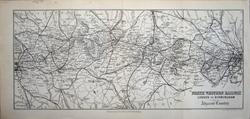 North Western Railway: London & Birmingham & Adjacent Country J Bartholomew 1883 - 35 x 15 cm For A & C Black's Guide to England & Wales. Three folds Larger image Ref uk1187 : £9 Return to Great Britain & Ireland Index |
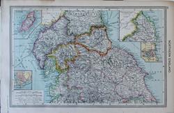 Northern England Geo. Philip c1907 - 35 x 23 cm Large antique coloured map. Insets of the Isle of Man, Barrow and Tynemouth. Larger image Ref uk1678 : £9 Return to Great Britain & Ireland Index |
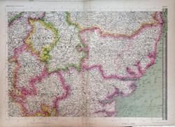 Northern Home Counties of England & East Anglia. The Imperial Map of England & Wales John Bartholomew, F.R.G.S. A Fullarton & Co. London & Edinburgh. 1868 - 69 x 49.5 cm Original antique map with original hand colouring of the county boundaries as issued. The Imperial Map of England & Wales according to the Ordnance Survey, with the latest additions; shewing clearly every feature of the country, railways and their stations, Roads, Canals, Rivers, Gentlemen's Seats, &c. &c. On the Scale of 4 Miles to an Inch. Creases down the map near the centrefold have been flattened and strengthened verso. Larger image 1 : Larger Image 2 Ref uk1731 : £24 Return to Great Britain & Ireland Index |
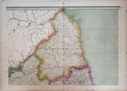 Northumberland with parts of Durham & Cumberland. The Imperial Map of England & Wales. John Bartholomew, F.R.G.S. A Fullarton & Co. London & Edinburgh. 1868 - 69 x 49.5 cm Original antique map with original hand colouring of the county boundaries as issued. The Imperial Map of England & Wales according to the Ordnance Survey, with the latest additions; shewing clearly every feature of the country, railways and their stations, Roads, Canals, Rivers, Gentlemen's Seats, &c. &c. On the Scale of 4 Miles to an Inch. Larger image 1 : Larger Image 2 Ref uk1721 : £22 Return to Great Britain & Ireland Index |
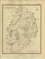 Nottinghamshire, North Creighton; J&C Walker 1835 - 19 x 25 cm East Retford showing Electoral Boundary changes. Contemporary hand colouring. Published by Samuel Lewis in View of the Representative History of England. Larger image Ref uk223 : £9 Return to Great Britain & Ireland Index |
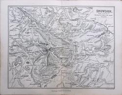 Snowdon & Vicinity. For A & C Black's Picturesque Guide to Wales 1881 - 18.5 x 14.5 cm Original antique map. Centrefold as issued. Closed split at the bottom of the fold. Larger image Ref uk1715 : £7 Return to Great Britain & Ireland Index |
 Somerset & Dorset John Ogilby 1675 - 50 x 37 cm The Road from Bristol to Weymouth com Dorset. Route is Bishop's Chue (sic), Wells, Glastonbury, Somerton, Martock, Crokehorn (sic), South Parret, Fram(p)ton and Weymouth. Six strip maps show the road, towns rivers and hills. A good strong impression with large margins in good condition except for some strengthening on edges and each end of the centrefold. The hand-colouring is probably contemporary as this map is printed on red-lined paper which was the case for some early copies. These are very rarely found today. This is NOT the reduced size facsimile from Duckham which is from an early red-lined edition. Larger image 1 : Larger Image 2 Ref uk1136 : £165 Return to Great Britain & Ireland Index |
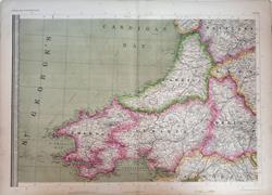 South & West Wales. The Imperial Map of England & Wales. John Bartholomew, F.R.G.S. A Fullarton & Co. London & Edinburgh. 1868 - 69 x 49.5 cm Original antique map with original hand colouring of the county boundaries as issued. The Imperial Map of England & Wales according to the Ordnance Survey, with the latest additions; shewing clearly every feature of the country, railways and their stations, Roads, Canals, Rivers, Gentlemen's Seats, &c. &c. On the Scale of 4 Miles to an Inch. Larger image 1 : Larger Image 2 Ref uk1729 : £22 Return to Great Britain & Ireland Index |
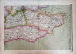 South East England; Kent, Surrey & Sussex. The Imperial Map of England & Wales. John Bartholomew, F.R.G.S. A Fullarton & Co. London & Edinburgh. 1868 - 69 x 49.5 cm Original antique map with original hand colouring of the county boundaries as issued. The Imperial Map of England & Wales according to the Ordnance Survey, with the latest additions; shewing clearly every feature of the country, railways and their stations, Roads, Canals, Rivers, Gentlemen's Seats, &c. &c. On the Scale of 4 Miles to an Inch. Larger image 1 : Larger Image 2 Ref uk1732 : £30 Return to Great Britain & Ireland Index |
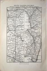 South Eastern Railway: Reigate to Dover, Canterbury, Deal, Ramsgate & Margate J Bartholomew 1883 - 9 x 14 cm For A & C Black's Guide to England & Wales Larger image Ref uk1182 : £3 Return to Great Britain & Ireland Index |
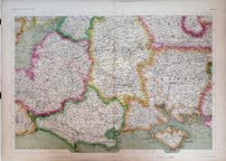 South of England; Somerset, Wiltshire, Berkshire, Hampshire & Dorset, etc. The Imperial Map of England & Wales. John Bartholomew, F.R.G.S. A Fullarton & Co. London & Edinburgh. 1868 - 69 x 49.5 cm Original antique map with original hand colouring of the county boundaries as issued. The Imperial Map of England & Wales according to the Ordnance Survey, with the latest additions; shewing clearly every feature of the country, railways and their stations, Roads, Canals, Rivers, Gentlemen's Seats, &c. &c. On the Scale of 4 Miles to an Inch. Larger image 1 : Larger Image 2 Ref uk1733 : £30 Return to Great Britain & Ireland Index |
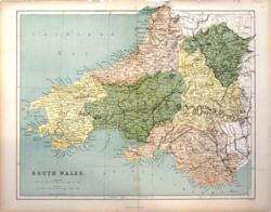 South Wales Hughes for Virtue & Co. 1868 - 30 x 24 cm Colour printed map of the Counties as far East as Abergavenny, showing roads and railways. Top edge strengthened. Larger image Ref uk732 : £5 Return to Great Britain & Ireland Index |
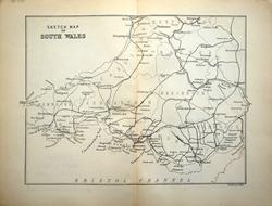 South Wales: Sketch Map J Bartholomew 1883 - 19 x 14 cm For A & C Black's Guide to England & Wales; centrefold Larger image Ref uk1198 : £4 Return to Great Britain & Ireland Index |
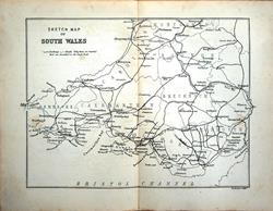 South Wales: Sketch Map J Bartholomew 1874 - 20 x 14.5 cm For A & C Black's Guide to England & Wales; centrefold Larger image Ref uk1598 : £7 Return to Great Britain & Ireland Index |
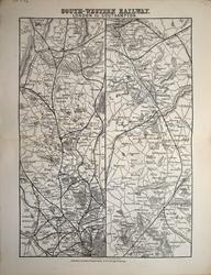 South-Western Railway: London to Southampton J Bartholomew 1883 - 14.5 x 21 cm For A & C Black's Guide to England & Wales; centrefold Larger image Ref uk1196 : £6 Return to Great Britain & Ireland Index |
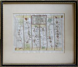 St. Albans to Oakham John Senex 1719 - 33.5 x 29 cm Road strip map: St. Albans, Luton, Bedford, Wellingborough, Kettering to Oakham. An Actual Survey of all the Principal Roads of England and Wales. Printed and sold by John Senex at the Globe in Salisbury Court, Fleet Street, 1719. The map is framed and glazed and measures 335 x 290 mm overall in the frame; mount window 230 x 170 mm. Hand coloured and in good clean condition. Not examined out of the frame. Larger image Ref uk1225 : £39 Return to Great Britain & Ireland Index |
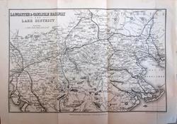 The Lake District, Lancaster and Carlisle Railway J Bartholomew. For A & C Black's Guide to England & Wales. 1874 - 23 x 15 cm Original antique uncoloured map with railway lines very clearly shown. Original folds. Six railway companies named. Larger image Ref uk1769 : £8 Return to Great Britain & Ireland Index |
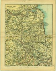 Tyne Ports; Black Country Geo. Philip & Son 1890 - 16 x 21 cm Sunderland, Tynemouth, Newcastle. Birmingham, Wolverhampton. Larger image Ref uk122 : £8 Return to Great Britain & Ireland Index |
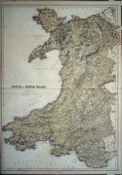 Wales J Bartholomew 1859 - 43.5 x 60 cm Large double page coloured map of North and South Wales. Larger image Ref uk1603 : £18 Return to Great Britain & Ireland Index |
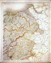 Wales, North East J & C Walker 1837 - 32 x 39 cm Fine original hand colouring of the hundreds and the county boundaries. Offered at half price because the item shows some foxing (exaggerated on the image). (See image). Larger image Ref uk872 : £12 Return to Great Britain & Ireland Index |
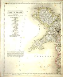 Wales, North West J & C Walker 1837 - 32 x 39 cm Fine original hand colouring of the hundreds and the county boundaries. Offered at half price because the item shows some foxing (exaggerated on the image). (See image). Larger image Ref uk871 : £12 Return to Great Britain & Ireland Index |
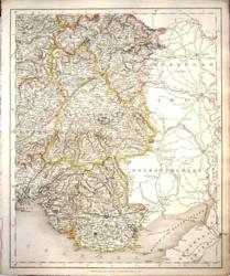 Wales, South East J & C Walker 1837 - 32 x 39 cm Fine original hand colouring of the hundreds and the county boundaries. Good condition. See the image. Shows various tramways around Merthyr. Larger image Ref uk874 : £26 Return to Great Britain & Ireland Index |
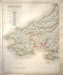 Wales, South West J & C Walker 1837 - 32 x 39 cm Fine original hand colouring of the hundreds and the county boundaries. Offered at half price because the item shows some foxing (exaggerated on the image). (See image). Shows an Old Rail Road near Llanelly. Larger image Ref uk873 : £12 Return to Great Britain & Ireland Index |
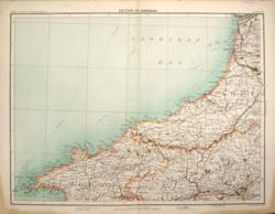 Wales, West. Parts of Cardiganshire, Pembrokeshire and Carmarthenshire. Cardigan Bartholomew c1898 - 42 x 32 cm From the River Dovey to Ramsey Island and Llandilo (sic). Finely printed map of the area with County boundaries, roads, woods and lakes in colour. Four miles to the inch. From Royal Atlas of England & Wales. Stain in the outer margin on two corners. Larger image Ref uk404 : £6 Return to Great Britain & Ireland Index |
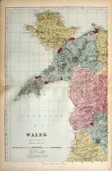 Wales: 4 sheets G W Bacon 1887 - 30 x 47 each cm With a table of explanation of words frequently occurring in the Welsh names of places, etc. Good condition except for a short piece of transparent water based tape on the LH edge front of both the NW and the SE sheets (see images). (Some hand colouring). Four images available. Larger image 1 : Larger Image 2 : Larger Image 3 : Larger Image 4 Ref uk743 : £14 Return to Great Britain & Ireland Index |
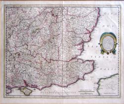 Warwicum, Northamtonia, etc. England: South East. Mercator, Hondius c1609 - 46 x 36 cm Warwicum, Northamtonia, Huntingdonia, Cantabrigia, Suffolcia, Oxonium Buckinghamia, Bedfordia, Hartfordia, Essexia, Berceria, Middelsexia, Southantonia, Surria, Cantium et Southsexia, hand coloured engraved map, Latin text on verso. "Sumpticus Henrici Hondy". An early map in very good condition. Larger image Ref uk392 : £175 Return to Great Britain & Ireland Index |
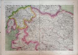 Westmoreland, most of Yorkshire & North Lancashire, S.E. Westmoreland & S. Durham. The Imperial Map of England & Wales. John Bartholomew, F.R.G.S. A Fullarton & Co. London & Edinburgh. 1868 - 69 x 49.5 cm Original antique map with original hand colouring of the county boundaries as issued. The Imperial Map of England & Wales according to the Ordnance Survey, with the latest additions; shewing clearly every feature of the country, railways and their stations, Roads, Canals, Rivers, Gentlemen's Seats, &c. &c. On the Scale of 4 Miles to an Inch. Larger image 1 : Larger Image 2 Ref uk1724 : £25 Return to Great Britain & Ireland Index |
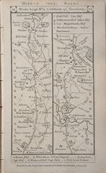 Wooler, Coldstream, Greenlaw, Lander & Blackshields. Printed and sold by Carington Bowles, 1785. 1785 - 9 x 17 cm Double sided map with two strip maps on each side from Patersonís British Itinerary of the Direct and Principal Roads of Great Britain. Scale approximately 6 miles to 5 cm (3 miles to 1 inch). Places named along the roads include the larger towns in 1785, spellings as engraved. Country seats and their owners are also shown. Larger image 1 : Larger Image 2 Ref uk1406 : £7 Return to Great Britain & Ireland Index |
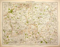 Worcestershire, Warwickshire, with parts of Gloucestershire and Oxfordshire. Warwick Bartholomew c1898 - 42 x 32 cm From Bridgnorth to Gloucester and Knighton to Daventry. Finely printed map of the area with County boundaries, roads, woods and lakes in colour. Four miles to the inch. From Royal Atlas of England & Wales. Stain in the outer margin on two corners. Larger image Ref uk405 : £6 Return to Great Britain & Ireland Index |
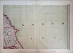 Yorkshire Coast. The Imperial Map of England & Wales. John Bartholomew, F.R.G.S. A Fullarton & Co. London & Edinburgh. 1868 - 69 x 49.5 cm Original antique map with original hand colouring of the county boundaries as issued. The Imperial Map of England & Wales according to the Ordnance Survey, with the latest additions; shewing clearly every feature of the country, railways and their stations, Roads, Canals, Rivers, Gentlemen's Seats, &c. &c. On the Scale of 4 Miles to an Inch. Larger image 1 : Larger Image 2 Ref uk1725 : £12 Return to Great Britain & Ireland Index |
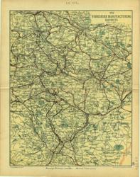 Yorkshire Manufacturing Geo. Philip & Son 1890 - 16 x 21 cm Leeds, Huddersfield, Wakefield, Bradford. Sheffield, Barnsley, Doncaster Larger image Ref uk123 : £8 Return to Great Britain & Ireland Index |
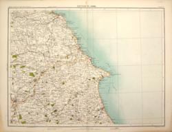 Yorkshire, East. York Bartholomew c1898 - 42 x 32 cm From the Cleveland Hills to Beverley and from York to the coast at Flamborough Head. Finely printed map of the area with County boundaries, roads, woods and lakes in colour. Four miles to the inch. From Royal Atlas of England & Wales. Stain in the outer margin on two corners. Larger image Ref uk397 : £6 Return to Great Britain & Ireland Index |
|||
> Section 1 > Section 2 > Section 3 | |||