| Home Page | Buying | Maps | Books | Prints | Ephemera |
- Home Page
- England & Wales County Maps Anglesea - Dorset
- England & Wales County Maps Durham - Merioneth
- England & Wales County Maps Midd'x - Somerset
- England & Wales County Maps Staffs - Yorks
- British Isles: Physical, Railways, Statistical, etc. Roman Britain
- England & Wales, Countries, Islands, Regions inc. the Lake District, Road & Rail Maps
- Scotland, the Country & Regions: Town Plans & Environs; Rail Maps
- Ireland, the Country, Regions & Environs
- England & Wales, Town Plans & Maps of Environs
- Ordnance Survey and Folding Maps

There are 10 pages of maps of the British Isles. Please see the index on the Great Britain page to gain access to 1000 maps of England, Wales, Scotland and Ireland.
All our maps are Originals, NOT modern reproductions and have thumbnails as well as larger images so it is easy to find what you are looking for.
If you want several items, email me for a discount!
Email: don@theoldmapman.com
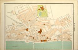 Blackpool Bartholomew c 1898 - 32 x 21 cm Detailed plan of the streets of the centre showing the Tower, the Alhambra, Claremont Rink, etc. Narrow bottom margin. Larger image Ref uk552 : £12 Return to Great Britain & Ireland Index |
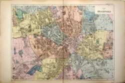 Bradford G W Bacon c 1898 - 43 x 31 cm Detailed hand wash coloured plan of the city as issued showing street names and a great many public buildings including the Union Workhouse, Fever Hospital, Rifle Barracks, etc. Area covered: From Manningham to East Bowling and from Horton to Undercliff. A very interesting map. Larger image Ref uk572 : £21 Return to Great Britain & Ireland Index |
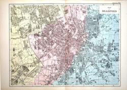 Bradford G W Bacon c1885 - 43 x 31 cm Detailed hand wash coloured plan of the city as issued showing street names and a great many public buildings including the Solid Tyre Mill, Union Workhouse, Fever Hospital, several Dye Works, the Football Ground with the adjacent Cricket Ground by Horton Park, many Mills and factories with their names and products, etc. Area covered: From Manningham to East Bowling and from Horton to Undercliff. A very interesting map in fine condition. Larger image Ref uk969 : £22 Return to Great Britain & Ireland Index |
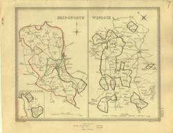 Bridgnorth and Wenlock Creighton; J&C Walker 1835 - 23 x 19 cm Parliamentary boundary maps showing the layout of the towns with the old and new boundaries shown in original outline hand colouring. Villages, hamlets and even individual properties are shown. Larger image Ref uk388 : £12 Return to Great Britain & Ireland Index |
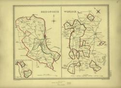 Bridgnorth and Wenlock Creighton; J&C Walker 1835 - 23 x 19 cm Parliamentary boundary maps showing the layout of the towns with the old and new boundaries shown in original outline hand colouring. Villages, hamlets and even individual properties are shown. Larger image Ref uk389 : £12 Return to Great Britain & Ireland Index |
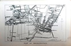 Bridlngton From: Black's Guide to the County of York. 1888 - 14 x 8.5 cm Original antique engraved map. Larger image Ref uk1793 : £8 Return to Great Britain & Ireland Index |
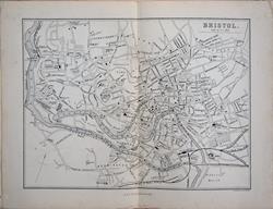 Bristol J Bartholomew 1874 - 19.5 x 14.5 cm For A & C Black's Guide to England & Wales; centrefold Larger image Ref uk1577 : £9 Return to Great Britain & Ireland Index |
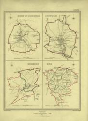 Bury St Edmunds, Ipswich, Sudbury & Eye Creighton; J&C Walker 1835 - 18 x 24 cm Parliamentary boundary maps showing the layout of the towns with the old and new boundaries shown in original outline hand colouring. Villages, hamlets and even individual properties are shown. Larger image Ref uk391 : £14 Return to Great Britain & Ireland Index |
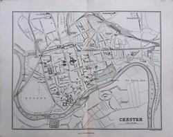 Chester For A & C Black's Picturesque Guide to Wales 1881 - 18 x 14 cm Original antique map. Centrefold as issued. Larger image Ref uk1712 : £9 Return to Great Britain & Ireland Index |
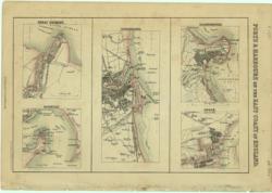 England's East Coast Ports Arch'd Fullarton c 1877 - 24 x 15 cm Coloured plans of Grimsby, Harwich, Sunderland, Scarborough and Goole with streets and maritime features. Larger image Ref uk551 : £10 Return to Great Britain & Ireland Index |
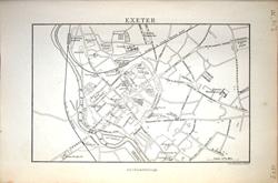 Exeter J Bartholomew 1883 - 14 x 9 cm For A & C Black's Guide to England & Wales Larger image Ref uk1208 : £4 Return to Great Britain & Ireland Index |
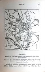 Halifax From: Black's Guide to the County of York. 1888 - 8 x 9 cm Original antique engraved map. Larger image 1 : Larger Image 2 Ref uk1795 : £4 Return to Great Britain & Ireland Index |
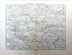 Harrogate Environs From: Black's Guide to the County of York. 1888 - 17 x 13.5 cm Original antique engraved map. Centrefold. Larger image Ref uk1797 : £9 Return to Great Britain & Ireland Index |
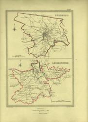 Hereford and Leominster Creighton; J&C Walker 1835 - 17 x 23 cm Parliamentary boundary maps showing the layout of the towns with the old and new boundaries shown in original outline hand colouring. Villages, hamlets and even individual properties are shown. Larger image Ref uk390 : £14 Return to Great Britain & Ireland Index |
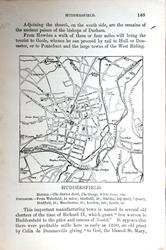 Huddersfield From: Black's Guide to the County of York. 1888 - 8 x 8 cm Original antique engraved map. Larger image 1 : Larger Image 2 Ref uk1798 : £4 Return to Great Britain & Ireland Index |
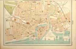 Hull Bartholomew c 1898 - 32 x 21 cm Detailed plan of the streets of the centre showing the Docks, 4 stations, tram tracks, Hymers College and the work house. Narrow top margin. Larger image Ref uk553 : £15 Return to Great Britain & Ireland Index |
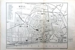 Hull From: Black's Guide to the County of York. 1888 - 19.5 x 14.5 cm Original antique engraved map. Two original folds. Larger image Ref uk1799 : £9 Return to Great Britain & Ireland Index |
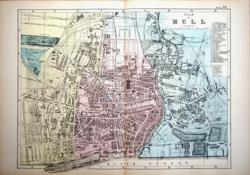 Hull G W Bacon c1885 - 43 x 32 cm Detailed revised hand wash coloured plan of the city as issued showing street names and features including the Alhambra Music Hall, Public Playground, Creosoting Works and the Docks and Basins. Area covered: From Westbourne Avenue and the Botanic Gardens to the Victoria Dock and the Timber Ponds and from Boulevard to Wilmington Station. A very interesting map in fine condition with a list of 49 public buildings. Larger image Ref uk979 : £22 Return to Great Britain & Ireland Index |
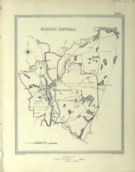 Kirkby Kendal, Westmorland Creighton; J&C Walker 1850 - 17 x 23 cm Parliamentary boundary maps showing the layout of the towns with the old and new boundaries shown in original outline hand colouring. Villages, hamlets and even individual properties are shown. Some very fine speckles on a part of the map, not immediately apparent, otherwise very nice condition. Larger image Ref uk760 : £13 Return to Great Britain & Ireland Index |
 Leeds From: Black's Guide to the County of York. 1888 - 19 x 14.5 cm Original antique engraved map. Centrefold. Larger image Ref uk1800 : £8 Return to Great Britain & Ireland Index |
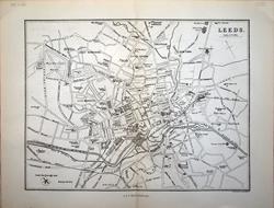 Leeds J Bartholomew 1883 - 19.5 x 14.5 cm For A & C Black's Guide to England & Wales. Slight toning near centrefold, (see image). Larger image Ref uk1168 : £7 Return to Great Britain & Ireland Index |
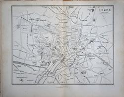 Leeds J Bartholomew 1874 - 19 x 14.5 cm For A & C Black's Guide to England & Wales; centrefold Larger image Ref uk1586 : £8 Return to Great Britain & Ireland Index |
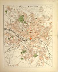 Leeds Mackenzie c 1894 - 22 x 28 cm Detailed coloured plan showing street names and a great many public buildings including Holbeck Union Workhouse, the Mechanics' Institute, House of Recovery, the Cavalry Barracks and the Gas works, etc. Area covered: Leeds Cricket Ground to Hunslet Lake and Wortley to the Knowesthorpe Cut. Larger image Ref uk561 : £18 Return to Great Britain & Ireland Index |
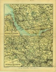 Liverpool & Manchester, Environs Geo. Philip & Son 1890 - 16 x 21 cm St Helens, Liverpool, Runcorn, Birkenhead. Manchester, Bolton, Rochdale, Oldham Larger image Ref uk121 : £8 Return to Great Britain & Ireland Index |
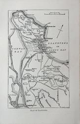 Llandudno For A & C Black's Picturesque Guide to Wales 1881 - 8 x 13.5 cm Original antique map printed on a leaf from this guidebook (text verso). Larger image Ref uk1713 : £5 Return to Great Britain & Ireland Index |
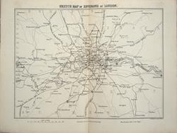 London Environs J Bartholomew 1874 - 19.5 x 15.5 cm For A & C Black's Guide to England & Wales; centrefold Larger image Ref uk1596 : £7 Return to Great Britain & Ireland Index |
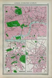 London, Edinburgh & Dublin George Philip for the Harmsworth Atlas. 1907 - 23.5 x 36 cm Large full page colour map shewing the centres of the three cities and naming important buildings. Larger image Ref uk1626 : £10 Return to Great Britain & Ireland Index |
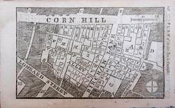 London. Fire of 1748 in Cornhill. From the Gentleman's Magazine, April 1748. 1748 - 13 x 21 cm Original antique plan showing the extent of the fire. Second sheet has a list of premises affected with their owners' business. Larger image 1 : Larger Image 2 Ref uk1772 : £12 Return to Great Britain & Ireland Index |
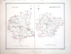 Malmesbury & Wilton Creighton; J&C Walker 1835 - 23 x 19 cm Parliamentary boundary maps showing the layout of the towns with the old and new boundaries shown in original outline hand colouring. Villages, hamlets and even individual properties are shown. Larger image Ref uk1006 : £10 Return to Great Britain & Ireland Index |
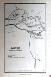 Malton From: Black's Guide to the County of York. 1888 - 9 x 14.5 cm Original antique engraved map. Larger image Ref uk1801 : £5 Return to Great Britain & Ireland Index |
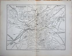 Manchester & Salford J Bartholomew 1874 - 19 x 14.5 cm For A & C Black's Guide to England & Wales; centrefold Larger image Ref uk1585 : £9 Return to Great Britain & Ireland Index |
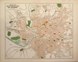 Manchester and Salford Mackenzie c 1894 - 28 x 23 cm Detailed coloured plan showing street names and a great many public buildings including Owens College, Salford Workhouse, the Fish Market and the Cavalry Barracks. Area covered: North of Cheetham Park to Alexandra Park and from Seedley to Ardwick. Crease across extreme top right corner otherwise in very good condition. Larger image Ref uk562 : £18 Return to Great Britain & Ireland Index |
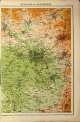 Manchester Environs Bartholomew c 1898 - 21 x 33 cm Area covered: Bolton, Bury, Rochdale, Oldham, Stockport, Hyde, Knutsford and Bollington. Stretford is in the country between Sale and Old Trafford. Narrow LH margin. Larger image Ref uk560 : £8 Return to Great Britain & Ireland Index |
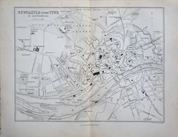 Newcastle upon Tyne J Bartholomew 1874 - 19 x 14.5 cm For A & C Black's Guide to England & Wales; centrefold Larger image Ref uk1589 : £9 Return to Great Britain & Ireland Index |
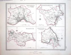 Newcastle upon Tyne, North Shields, Morpeth & Berwick upon Tweed Creighton; J&C Walker 1835 - 23 x 19 cm Parliamentary boundary maps showing the layout of the towns with the old and new boundaries shown in original outline hand colouring. Villages, hamlets and even individual properties are shown. Larger image Ref uk1007 : £12 Return to Great Britain & Ireland Index |
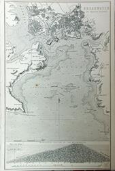 Plymouth Sound c1890 - 15 x 24 cm Original antique engraved map which is to illustrate an encyclopaedia article on Breakwaters (included). One small spot. (See image). Larger image Ref uk1782 : £5 Return to Great Britain & Ireland Index |
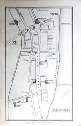 Redcar From: Black's Guide to the County of York. 1888 - 9 x 14.5 cm Original antique engraved map. Larger image Ref uk1803 : £6 Return to Great Britain & Ireland Index |
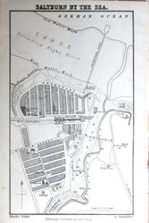 Saltburn by the Sea From: Black's Guide to the County of York. 1888 - 9 x 15 cm Original antique engraved map. Larger image Ref uk1805 : £6 Return to Great Britain & Ireland Index |
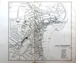 Scarborough From: Black's Guide to the County of York. 1888 - 15.5 x 14.5 cm Original antique engraved map. One original fold. Note the inscribed date by the Title. Larger image Ref uk1807 : £8 Return to Great Britain & Ireland Index |
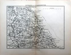 Scarborough Environs From: Black's Guide to the County of York. 1888 - 17 x 13 cm Original antique engraved map. Centrefold. Larger image Ref uk1806 : £9 Return to Great Britain & Ireland Index |
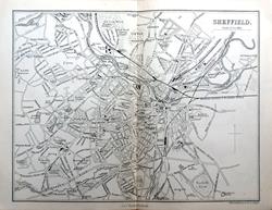 Sheffield From: Black's Guide to the County of York. 1888 - 19.5 x 14.5 cm Original antique engraved map. Centrefold. Larger image Ref uk1808 : £10 Return to Great Britain & Ireland Index |
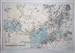 Tunbridge Wells G W Bacon. Narrow lower margin. A very interesting map, in nice condition. c 1885 - 32 x 21 cm Detailed hand wash coloured plan of the town, as issued showing most street names and a great many institutions including the Pump Room, the Assembly Rooms, the Hydropathic Establishment and Toad Rock, etc. Area covered: From Rusthall Common to Prospect Hill and from The Lew to LB&SCR Station. Larger image Ref uk1651 : £10 Return to Great Britain & Ireland Index |
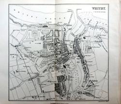 Whitby From: Black's Guide to the County of York. 1888 - 15.5 x 15 cm Original antique engraved map. Centrefold. Larger image Ref uk1809 : £10 Return to Great Britain & Ireland Index |
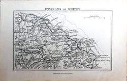 Whitby Environs From: Black's Guide to the County of York. 1888 - 12.5 x 8 cm Original antique engraved map. Larger image Ref uk1810 : £5 Return to Great Britain & Ireland Index |
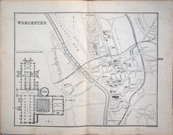 Worcester J Bartholomew 1874 - 19 x 15 cm For A & C Black's Guide to England & Wales; centrefold Larger image Ref uk1579 : £7 Return to Great Britain & Ireland Index |
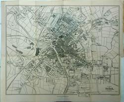 York From: Black's Guide to the County of York. 1888 - 32 x 26 cm Original antique engraved map. Original folds. Larger image Ref uk1791 : £25 Return to Great Britain & Ireland Index |
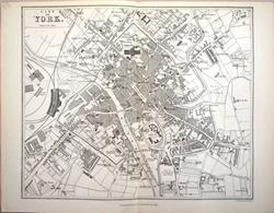 York J Bartholomew 1883 - 20 x 16 cm For A & C Black's Guide to England & Wales. Slight toning near centrefold, (see image). Larger image Ref uk1178 : £7 Return to Great Britain & Ireland Index |
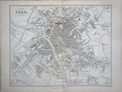 York J Bartholomew 1874 - 19 x 15.5 cm For A & C Black's Guide to England & Wales; centrefold Larger image Ref uk1591 : £9 Return to Great Britain & Ireland Index |
| |||