| Home Page | Buying | Maps | Books | Prints | Ephemera |
- Home Page
- England & Wales County Maps Anglesea - Dorset
- England & Wales County Maps Durham - Merioneth
- England & Wales County Maps Midd'x - Somerset
- England & Wales County Maps Staffs - Yorks
- British Isles: Physical, Railways, Statistical, etc. Roman Britain
- England & Wales, Countries, Islands, Regions inc. the Lake District, Road & Rail Maps
- Scotland, the Country & Regions: Town Plans & Environs; Rail Maps
- Ireland, the Country, Regions & Environs
- England & Wales, Town Plans & Maps of Environs
- Ordnance Survey and Folding Maps

There are 10 pages of maps of the British Isles. Please see the index on the Great Britain page to gain access to 1000 maps of England, Wales, Scotland and Ireland.
All our maps are Originals, NOT modern reproductions and have thumbnails as well as larger images so it is easy to find what you are looking for.
If you want several items, email me for a discount!
Email: don@theoldmapman.com
> Section 1 > Section 2 > Section 3
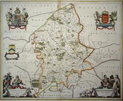 Staffordiensis Comitatus Vulgo Stafford Shire Joan Blaeu c1645 - 51 x 42 cm Engraved map with original hand colouring. Slight browning to centre fold, outside printed area except for 3 cm at top (exaggerated on the image), otherwise a fine copy. German text on verso. Larger image 1 : Larger Image 2 : Larger Image 3 : Larger Image 4 Ref uk394 : £175 Return to Great Britain & Ireland Index |
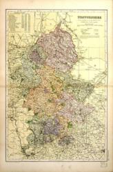 Staffordshire G W Bacon 1897 - 31 x 46 cm Large double page coloured map with woods, parks, hills, roads and railways. The railway companies are named on each line. Has a strengthened or repaired centrefold and the join can be seen. Larger image Ref uk535 : £3 Return to Great Britain & Ireland Index |
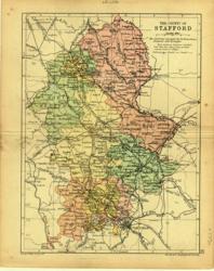 Staffordshire Geo. Philip & Son 1890 - 15 x 21 cm Printed colour hundreds. Large number of railway lines. Larger image Ref uk106 : £7 Return to Great Britain & Ireland Index |
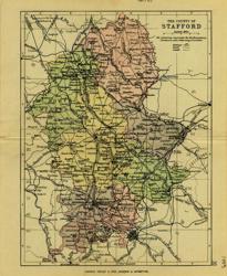 Staffordshire Geo. Philip & Son 1889 - 15 x 21 cm Printed colour hundreds. Large number of railway lines. Larger image Ref uk107 : £7 Return to Great Britain & Ireland Index |
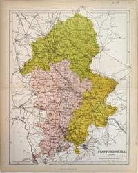 Staffordshire Hughes for Virtue & Co. 1868 - 24 x 31 cm Colour printed map of the county showing roads and railways. The Divisions in different colours. Larger image Ref uk439 : £6 Return to Great Britain & Ireland Index |
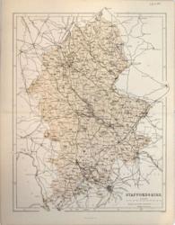 Staffordshire Hughes for Virtue & Co. 1868 - 24 x 31 cm Colour printed map of the county showing roads and railways. Larger image Ref uk440 : £5 Return to Great Britain & Ireland Index |
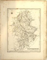 Staffordshire J & C Walker / Lewis c1840 - 18 x 23 cm Uncoloured map. No railways. Several canals clearly marked. A little foxing, almost all outside the printed area. Larger image Ref uk363 : £7 Return to Great Britain & Ireland Index |
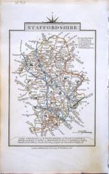 Staffordshire John Cary 1822 - 9 x 14 cm Original hand colouring of roads, woodland and the county boundaries. Slight toning around the margins. Larger image Ref uk820 : £15 Return to Great Britain & Ireland Index |
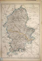 Staffordshire John Dower 1858 - 31 x 43 cm Original outline colour. A large map by Day & Son lithographed for the Weekly Dispatch Atlas. Centrefold and some edges outside the engraved area strengthened. Larger image Ref uk203 : £10 Return to Great Britain & Ireland Index |
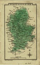 Staffordshire S Leigh 1830 - 7 x 12 cm Wash colouring Larger image Ref uk048 : £10 Return to Great Britain & Ireland Index |
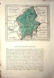 Staffordshire Seller / Grose 1773/87 - 15 x 12 cm Original hand wash colour. Map on half page with text below and on verso. Sheet 17 x 26. Larger image Ref uk1018 : £16 Return to Great Britain & Ireland Index |
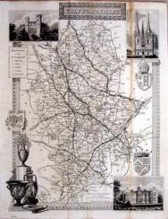 Staffordshire Thomas Moule c1845 - 28 x 22 cm Decorative map with vignettes and coats of arms. Uncoloured as issued. As is often the case with these maps there are several original folds. A band of foxing along a fold (see image). Several railways are shown. Larger image Ref uk1069 : £9 Return to Great Britain & Ireland Index |
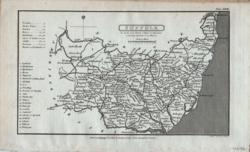 Suffolk Cooper for R. Phillips 1808 - 18 x 11 cm Uncoloured detailed map in which is laid down every Parish & Place containing upwards of 40 houses; table of information on the county Larger image Ref uk152 : £14 Return to Great Britain & Ireland Index |
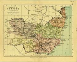 Suffolk Geo. Philip & Son 1889 - 20 x 15 cm Printed colour hundreds. Large number of railway lines. Larger image Ref uk108 : £7 Return to Great Britain & Ireland Index |
 Suffolk & Surr(e)y John Cary 1792 - 10.5 x 16 cm Antique double sided maps from The Traveller's Companion, with original fine hand colouring of boundaries, roads, towns & parks. No Larger Image Ref uk1848 : £20 Return to Great Britain & Ireland Index |
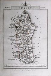 Sussex & Warwickshire John Cary 1792 - 10.5 x 16 cm Antique double sided maps from The Traveller's Companion, with original fine hand colouring of boundaries, roads, towns & parks. No Larger Image Ref uk1849 : £18 Return to Great Britain & Ireland Index |
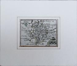 Warwicke-shire. (Warwickshire). Pieter van den Keere. 1627 - 15 x 10.5 cm Original antique Miniature Speed map with subtle hand colouring, in a gilt hand-ruled ivory bevel cut mount (24.5 x 21 cm). Descriptive text verso. Lower margin extended with old paper. Single worm hole lower left. The strength of the impression would indicate an early edition, probably 1627. Sold by George Humble. No Larger Image Ref uk1861 : £75 Return to Great Britain & Ireland Index |
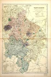 Warwickshire G W Bacon 1897 - 30 x 46 cm Large double page coloured map with woods, parks, hills, roads and railways. The railway companies are named on each line. Has a strengthened or repaired centrefold and the join can be seen. Larger image Ref uk542 : £3 Return to Great Britain & Ireland Index |
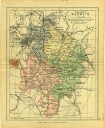 Warwickshire Geo. Philip & Son 1880 - 16 x 20 cm Printed colour hundreds. Large number of railway lines. Rust stain on centrefold outside the county boundary. Larger image Ref uk109 : £5 Return to Great Britain & Ireland Index |
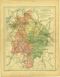 Warwickshire Geo. Philip & Son 1890 - 16 x 20 cm Printed colour hundreds. Large number of railway lines. Larger image Ref uk111 : £7 Return to Great Britain & Ireland Index |
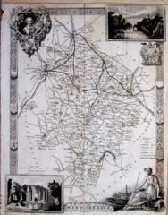 Warwickshire Thomas Moule c1845 - 28 x 22 cm Decorative map with vignettes and coats of arms. Uncoloured as issued. As is often the case with these maps there are several original folds and the engraving reaches almost to an edge of the sheet where an old paper extension will make fitting it to a mount easier. Several railways are shown. Larger image Ref uk1073 : £15 Return to Great Britain & Ireland Index |
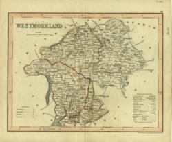 Westmoreland Archer 1840 - 24 x 18 cm Original wash colouring border with fine outline colouring of the hundreds. Larger image Ref uk145 : £11 Return to Great Britain & Ireland Index |
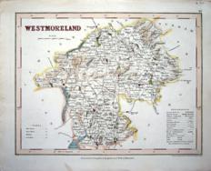 Westmoreland Archer for Dugdale c1850 - 24 x 18 cm Hand coloured map of the county; some of this colouring may be original. Closed short marginal tear. Larger image Ref uk1104 : £11 Return to Great Britain & Ireland Index |
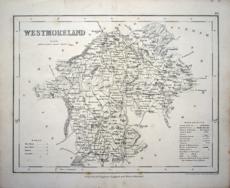 Westmoreland Archer for Dugdale c1850 - 24 x 18 cm Uncoloured map in nice condition with tables of wards and explanations. Closed short marginal tear. Larger image Ref uk1105 : £7 Return to Great Britain & Ireland Index |
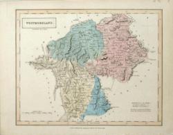 Westmoreland Chapman & Hall 1833 - 25 x 20 cm Original wash hand colouring. One straight crease across near the foot. Supplied with text sheet. Larger image Ref uk770 : £13 Return to Great Britain & Ireland Index |
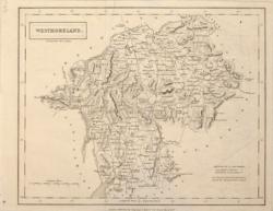 Westmoreland Chapman & Hall 1832 - 25 x 20 cm Uncoloured map. 2 original folds, some creasing and a faint offsetting. Larger image Ref uk777 : £9 Return to Great Britain & Ireland Index |
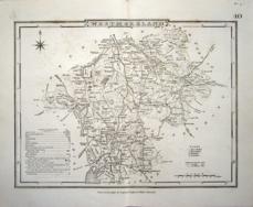 Westmoreland Cole & Roper for Dugdale 1835 - 23 x 18 cm Uncoloured map in nice condition with tables of distances, wards and explanations. Larger image Ref uk1106 : £10 Return to Great Britain & Ireland Index |
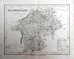 Westmoreland Drawn & engraved by J. Archer, Pentonville, London for Dugdale's England and Wales Delineated. c1835 - 23.5 x 18 cm Original antique uncoloured engraved map. Centrefold as issued. Early copy without railways. Larger image Ref uk1778 : £6 Return to Great Britain & Ireland Index |
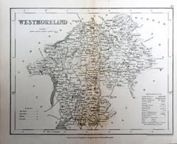 Westmoreland Drawn & engraved by J. Archer, Pentonville, London for Dugdale's England and Wales Delineated. c1835 - 23.5 x 18 cm Original antique uncoloured engraved map. Centrefold as issued. Early copy without railways. Larger image Ref uk1779 : £6 Return to Great Britain & Ireland Index |
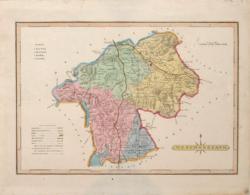 Westmoreland G. Ellis 1819 - 26 x 18 cm Hand wash colouring. A light stain, two marginal short repaired tears but otherwise in good condition. Larger image Ref uk774 : £13 Return to Great Britain & Ireland Index |
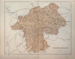 Westmoreland Hughes for Virtue & Co. c1860 - 30 x 24 cm Colour printed map of the county showing roads and railways. Top edge strengthened. Larger image Ref uk444 : £6 Return to Great Britain & Ireland Index |
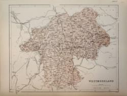 Westmoreland Hughes for Virtue & Co. 1873 - 30 x 24 cm Colour printed map of the county showing roads and railways. Unfolded. Larger image Ref uk445 : £6 Return to Great Britain & Ireland Index |
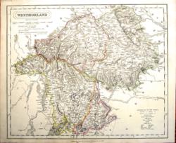 Westmoreland J & C Walker 1837 - 39 x 32 cm Fine original hand colouring of the hundreds and the county boundaries. Good condition. See the image. Larger image Ref uk865 : £22 Return to Great Britain & Ireland Index |
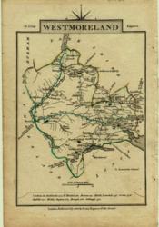 Westmoreland John Cary 1806 - 9 x 15 cm Original outline colouring inc some roads, woods and towns Larger image Ref uk050 : £18 Return to Great Britain & Ireland Index |
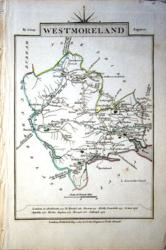 Westmoreland John Cary 1810 - 9 x 14 cm Original hand colouring of roads, woodland and the county boundaries. Slight creasing upper right. Larger image Ref uk1028 : £12 Return to Great Britain & Ireland Index |
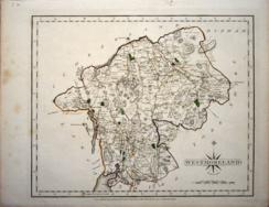 Westmoreland John Cary 1821 - 27 x 21 cm Fine quality original hand colouring of roads, woodland and the county boundaries from the first edition of the New English Atlas. A little foxing though mainly in the mrgins. Larger image Ref uk1081 : £22 Return to Great Britain & Ireland Index |
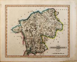 Westmoreland John Cary 1821 - 27 x 21 cm The very finest quality original hand colouring of roads, woodland and the county boundaries. Supplied with a separate sheet describing the county and its industry, farming, gentry and environment, together with a list of the country seats and The most remarkable Places for extensive Prospects, etc. Larger image Ref uk289 : £28 Return to Great Britain & Ireland Index |
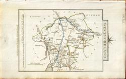 Westmoreland John Cary 1822 - 9 x 14 cm Original hand colouring of roads, woodland and the county boundaries. Slight toning around the margins. Larger image Ref uk825 : £15 Return to Great Britain & Ireland Index |
 Westmoreland Robert Dawson 1832 - 26 x 25 cm Hand coloured in outline and the Towns and Lakes. Shows the Ward Boundaries and principal towns. Larger image Ref uk776 : £11 Return to Great Britain & Ireland Index |
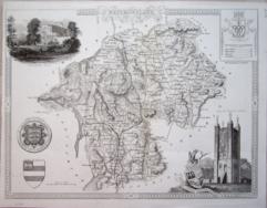 Westmoreland Thomas Moule c1845 - 28 x 22 cm Decorative map with vignettes and coats of arms. Uncoloured as issued. As is often the case with these maps there are several original folds. Several railways are shown. Larger image Ref uk1074 : £14 Return to Great Britain & Ireland Index |
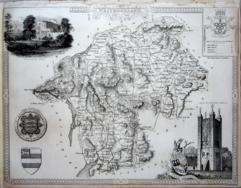 Westmoreland Thomas Moule c1845 - 28 x 22 cm Decorative map with vignettes and coats of arms. Uncoloured as issued. As is often the case with these maps the engraving reaches almost to an edge of the sheet where an old paper extension will make fitting it to a mount easier. No railways are shown. Larger image Ref uk1121 : £11 Return to Great Britain & Ireland Index |
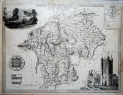 Westmoreland Thomas Moule c1845 - 28 x 22 cm Decorative map with vignettes and coats of arms. Uncoloured as issued. As is often the case with these maps the engraving reaches almost to an edge of the sheet where an old paper extension will make fitting it to a mount easier. A railway is shown. Water stains RH side. Larger image Ref uk1122 : £8 Return to Great Britain & Ireland Index |
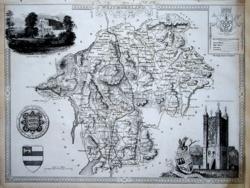 Westmoreland Thomas Moule c1845 - 28 x 22 cm Decorative map with vignettes and coats of arms. Uncoloured as issued. As is often the case with these maps the engraving reaches almost to an edge of the sheet where an old paper extension will make fitting it to a mount easier. A railway is shown. Some creases and a stain in a lower corner. Larger image Ref uk1123 : £9 Return to Great Britain & Ireland Index |
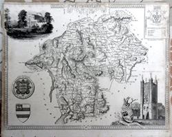 Westmoreland Thomas Moule c 1845 - 27 x 20 cm Original antique engraved map. Vignettes of Brougham Hall and Appleby Castle, plus Arms. Only the lower margin substantial. The others suffer from the usual Moule problem of close cropping from inclusion in his 2 volume The English Counties Delineated. A rather scruffy copy, see image. Larger image Ref uk1777 : £7 Return to Great Britain & Ireland Index |
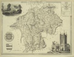 Westmoreland Thomas Moule c 1845 - 26 x 20 cm Uncoloured decorative map of the County with two vignettes and four coats of arms. Two margins quite tight but would mount up OK. The odd spot. Lanaster to Carlisle rail track shown with a branch line to Rayrigg from Kendal. The image is a good representation of the condition of the map. Larger image Ref uk758 : £11 Return to Great Britain & Ireland Index |
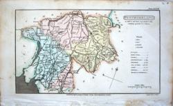 Westmoreland Cooper for R. Phillips 1808 - 17 x 10 cm Detailed map in which is laid down every Parish & Place containing upwards of 20 houses. Larger image Ref uk1020 : £6 Return to Great Britain & Ireland Index |
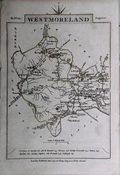 Westmoreland & Wiltshire John Cary 1792 - 10.5 x 16 cm Antique double sided maps from The Traveller's Companion, with original fine hand colouring of boundaries, roads, towns & parks. No Larger Image Ref uk1850 : £16 Return to Great Britain & Ireland Index |
 Westmorland Creighton; J&C Walker 1850 - 23 x 18 cm Political Boundary map. Hand coloured in outline. Larger image Ref uk1102 : £8 Return to Great Britain & Ireland Index |
> Section 1 > Section 2 > Section 3 | |||