| Home Page | Buying | Maps | Books | Prints | Ephemera |
- Home Page
- England & Wales County Maps Anglesea - Dorset
- England & Wales County Maps Durham - Merioneth
- England & Wales County Maps Midd'x - Somerset
- England & Wales County Maps Staffs - Yorks
- British Isles: Physical, Railways, Statistical, etc. Roman Britain
- England & Wales, Countries, Islands, Regions inc. the Lake District, Road & Rail Maps
- Scotland, the Country & Regions: Town Plans & Environs; Rail Maps
- Ireland, the Country, Regions & Environs
- England & Wales, Town Plans & Maps of Environs
- Ordnance Survey and Folding Maps

There are 10 pages of maps of the British Isles. Please see the index on the Great Britain page to gain access to 1000 maps of England, Wales, Scotland and Ireland.
All our maps are Originals, NOT modern reproductions and have thumbnails as well as larger images so it is easy to find what you are looking for.
If you want several items, email me for a discount!
Email: don@theoldmapman.com
> Section 1 > Section 2 > Section 3
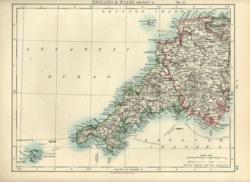 England & Wales: The South West. Verso: The South East W & A K Johnston 1897 - 26 x 20 cm Devon & Cornwall and the Scillies. Verso: The Greater South East bounded by Ipswich, Newport Pagnell, Oxford and Winchester. Fine outline coloured maps. Two images available. Larger image 1 : Larger Image 2 Ref uk707 : £9 Return to Great Britain & Ireland Index |
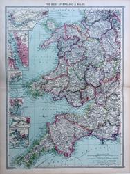 England & Wales: The West. Geo. Philip c1907 - 35 x 48 cm Very large double page coloured map, with centrefold. Insets of ports of Liverpool, Cardiff, Barry & Bristol. Also the Manchester Ship Canal and Plymouth Sound. Larger image Ref uk1670 : £12 Return to Great Britain & Ireland Index |
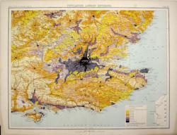 England: South East, Population Bartholomew c1898 - 42 x 32 cm Warwick, Cambridge and Aldeburgh to the North and Swindon, Salisbury and Bournemouth to the West. Population density is shown by colours. From Royal Atlas of England & Wales. Stain in the outer margin on two corners. Larger image Ref uk410 : £9 Return to Great Britain & Ireland Index |
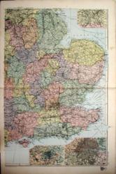 England: The East G W Bacon 1897 - 31 x 47 cm Coloured map of the East of England from Huddersfield to Bournemouth and from the Humber to the Straits of Dover with insets of the environs of Sheffield, Birmingham and London. A clean and tidy map which clearly shows the enormous railway network at this time. Larger image Ref uk568 : £9 Return to Great Britain & Ireland Index |
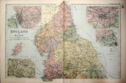 England: The North G W Bacon 1897 - 48 x 33 cm Coloured map of the North of England and the Isle of Man with insets of the environs of Liverpool, Leeds, Manchester and Newcastle. A little foxing in the lower margin but only a very small spot or two on the Irish Sea. Larger image Ref uk567 : £8 Return to Great Britain & Ireland Index |
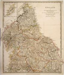 England: The North SDUK/ Baldwin & Cradock/ J & C Walker 1831 - 32 x 37 cm Hand coloured in outline as issued, covering the North of England with an inset of the Isle of Man, as far South as Liverpool and Sheffield. Edge tears repaired and a small piece at one corner has been re-connected to the map itself. Not noticeable; see image. Larger image Ref uk566 : £28 Return to Great Britain & Ireland Index |
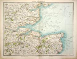 Essex, Kent. Canterbury Bartholomew c1898 - 42 x 32 cm From Hatfield Broad Oak to Tunbridge Wells and from Romford to the North Foreland. Finely printed map of the area with County boundaries, roads, woods and lakes in colour. Four miles to the inch. From Royal Atlas of England & Wales. Stain in the outer margin on two corners. Larger image Ref uk407 : £6 Return to Great Britain & Ireland Index |
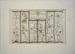 Gloucestershire to Worcestershire. Thomas Gardner. Mount window 295 x 180mm. 1719 - 39 x 28 cm Original antique road map from Bristol to Worcester, via Dursley, Gloucester and Tewkesbury. Later hand colouring and in an ivory bevelled mount. Centrefold as issued. Larger image 1 : Larger Image 2 Ref uk1649 : £48 Return to Great Britain & Ireland Index |
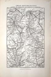 Great Eastern Railway: London to Cambridge, Ely, Norwich & Yarmouth J Bartholomew 1883 - 9 x 14 cm For A & C Black's Guide to England & Wales Larger image Ref uk1181 : £3 Return to Great Britain & Ireland Index |
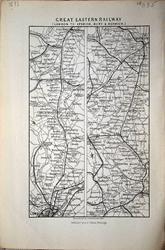 Great Eastern Railway: London to Ipswich, Bury & Norwich J Bartholomew 1883 - 9 x 14 cm For A & C Black's Guide to England & Wales Larger image Ref uk1185 : £3 Return to Great Britain & Ireland Index |
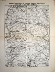 Great Western & South-Devon Railway: Bristol to Exeter & Plymouth J Bartholomew 1883 - 14.5 x 21 cm For A & C Black's Guide to England & Wales; centrefold Larger image Ref uk1194 : £6 Return to Great Britain & Ireland Index |
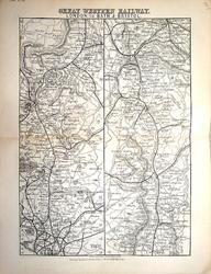 Great Western Railway: London to Bath & Bristol J Bartholomew 1883 - 14.5 x 21 cm For A & C Black's Guide to England & Wales; centrefold Larger image Ref uk1195 : £6 Return to Great Britain & Ireland Index |
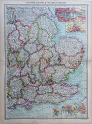 Home Counties & East of England. Geo. Philip c1907 - 35 x 48 cm Very large double page coloured map, with centrefold. Insets of ports of London, Hull, Dover, Portsmouth & Southampton. Larger image Ref uk1669 : £12 Return to Great Britain & Ireland Index |
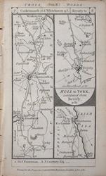 Ireby, Cockermouth, Workington, Whitehaven. Beverly, Weighton, Pocklington, York. Oxford, Wheatley. Printed and sold by Carington Bowles, 1785. 1785 - 9 x 17 cm Double sided map with two strip maps on each side from Patersonís British Itinerary of the Direct and Principal Roads of Great Britain. Scale approximately 6 miles to 5 cm (3 miles to 1 inch). Places named along the roads include the larger towns in 1785, spellings as engraved. Country seats and their owners are also shown. Larger image 1 : Larger Image 2 Ref uk1439 : £7 Return to Great Britain & Ireland Index |
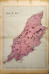 Isle of Man G W Bacon 1887 - 31 x 43 cm Large double page hand coloured map as issued with woods, parks, hills, roads and railways. Very much strengthened margins (see image) but the map itself unblemished so mounted would look good (as in second image). Larger image 1 : Larger Image 2 Ref uk494 : £14 Return to Great Britain & Ireland Index |
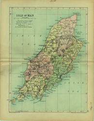 Isle of Man Geo. Philip & Son 1890 - 16 x 20 cm Printed colour hundreds. Large number of railway lines. Larger image Ref uk088 : £7 Return to Great Britain & Ireland Index |
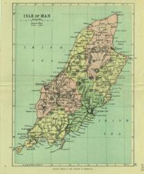 Isle of Man Geo. Philip & Son 1889 - 16 x 20 cm Printed colour hundreds. Large number of railway lines. Larger image Ref uk089 : £7 Return to Great Britain & Ireland Index |
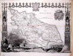 Isle of Man Thomas Moule c1845 - 28 x 22 cm Decorative map with vignettes and coats of arms. Uncoloured as issued. As is often the case with these maps there are several original folds and the engraving reaches an edge of the sheet where an old paper extension will make fitting it to a mount easier. A short edge tear is closed. Larger image Ref uk1053 : £16 Return to Great Britain & Ireland Index |
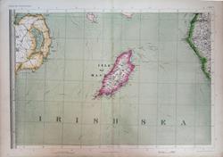 Isle of Man with parts of Northern Ireland & Cumberland. The Imperial Map of England & Wales. John Bartholomew, F.R.G.S. A Fullarton & Co. London & Edinburgh. 1868 - 69 x 49.5 cm Original antique map with original hand colouring of the county boundaries as issued. The Imperial Map of England & Wales according to the Ordnance Survey, with the latest additions; shewing clearly every feature of the country, railways and their stations, Roads, Canals, Rivers, Gentlemen's Seats, &c. &c. On the Scale of 4 Miles to an Inch. Larger image 1 : Larger Image 2 Ref uk1723 : £18 Return to Great Britain & Ireland Index |
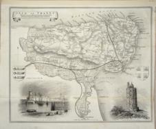 Isle of Thanet Thomas Moule c1845 - 28 x 22 cm Decorative map with vignettes and coats of arms. Uncoloured as issued. As is often the case with these maps there are several original folds and the engraving reaches an edge of the sheet where an old paper extension will make fitting it to a mount easier. A short edge tear is closed. Several railways are shown. Larger image Ref uk1037 : £15 Return to Great Britain & Ireland Index |
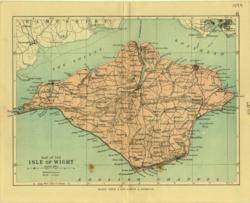 Isle of Wight Geo. Philip & Son 1889 - 22 x 15 cm Printed colour hundreds. Large number of railway lines. Only the one stain on the sea obvious in reality. Larger image Ref uk090 : £5 Return to Great Britain & Ireland Index |
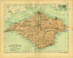 Isle of Wight Geo. Philip & Son 1890 - 22 x 15 cm Printed colour hundreds. Large number of railway lines. Larger image Ref uk091 : £7 Return to Great Britain & Ireland Index |
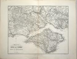 Isle of Wight and Part of Hampshire J Bartholomew 1883 - 19 x 14.5 cm For A & C Black's Guide to England & Wales; centrefold Larger image Ref uk1199 : £6 Return to Great Britain & Ireland Index |
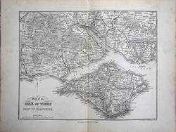 Isle of Wight and Part of Hampshire J Bartholomew 1874 - 18.5 x 14.5 cm For A & C Black's Guide to England & Wales; centrefold Larger image Ref uk1593 : £9 Return to Great Britain & Ireland Index |
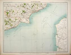 Kent, Sussex. Dover Bartholomew c1898 - 42 x 32 cm From Marden to Hastings and from Wye to Dover. The Strait of Dover and part of France from Calais, via Boulogne to Etaples. Finely printed map of the area with County boundaries, roads, woods and lakes in colour. Four miles to the inch. From Royal Atlas of England & Wales. Stain in the outer margin on two corners. Larger image Ref uk408 : £6 Return to Great Britain & Ireland Index |
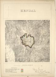 Lake District, Kendal boundaries Henry James 1868 - 22 x 33 cm Boundary Commission†map accompanied by a page of descriptive text relating to the borough. Zincographed at the Ordnance Survey. Original printed colouring of boundaries Larger image Ref uk775 : £11 Return to Great Britain & Ireland Index |
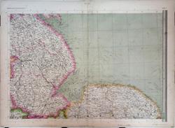 Lincolnshire & North Norfolk. The Imperial Map of England & Wales. John Bartholomew, F.R.G.S. A Fullarton & Co. London & Edinburgh. 1868 - 69 x 49.5 cm Original antique map with original hand colouring of the county boundaries as issued. The Imperial Map of England & Wales according to the Ordnance Survey, with the latest additions; shewing clearly every feature of the country, railways and their stations, Roads, Canals, Rivers, Gentlemen's Seats, &c. &c. On the Scale of 4 Miles to an Inch. Larger image 1 : Larger Image 2 Ref uk1726 : £22 Return to Great Britain & Ireland Index |
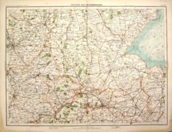 Lincolnshire, Rutland, with parts of Nottinghamshire, Leicestershire, Northamptonshire and Cambridgeshire. Peterborough Bartholomew c1898 - 42 x 32 cm From Nottingham to Kings Lynn and from Newark to Market Harboro'. Finely printed map of the area with County boundaries, roads, woods and lakes in colour. Four miles to the inch. From Royal Atlas of England & Wales. Stain in the outer margin on two corners. Larger image Ref uk403 : £6 Return to Great Britain & Ireland Index |
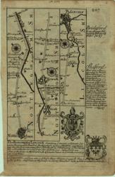 Lincs & Notts Bowen, Owen 1720/1764 - 12 x 18 cm Uncoloured strip map Nottingham to Lincoln with descriptions of Lincoln and Shelford & on verso Lincoln to Grimsby with description of Grimsby. 4 Coats of Arms. Two images available. Larger image 1 : Larger Image 2 Ref uk059 : £12 Return to Great Britain & Ireland Index |
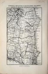 London & Brighton & South-Coast Railways: London to Brighton Portsmouth & Hastings J Bartholomew 1883 - 9 x 14 cm For A & C Black's Guide to England & Wales Larger image Ref uk1184 : £3 Return to Great Britain & Ireland Index |
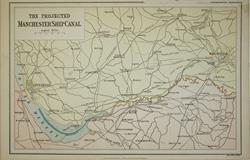 Manchester Ship Canal (Projected). Wm MacKenzie c1885 - 23.5 x 15 cm Original antique coloured map at a scale of about 4.5 miles to the inch showing the proposed route as well as railways, canals and main roads. Larger image Ref uk1783 : £5 Return to Great Britain & Ireland Index |
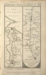 Manningtree, Harwich. Chelmsford, Braintree, Halstead, Sudbury, Lavenham & Bury St. Edmunds. Printed and sold by Carington Bowles, 1785. 1785 - 9 x 17 cm Double sided map with two strip maps on each side from Patersonís British Itinerary of the Direct and Principal Roads of Great Britain. Scale approximately 6 miles to 5 cm (3 miles to 1 inch). Places named along the roads include the larger towns in 1785, spellings as engraved. Country seats and their owners are also shown. Larger image 1 : Larger Image 2 Ref uk1433 : £7 Return to Great Britain & Ireland Index |
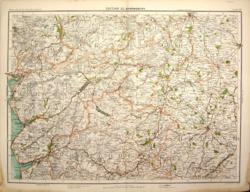 Merionethshire, with Denbighshire, Montgomery and much of Shropshire. Shrewsbury Bartholomew c1898 - 42 x 32 cm From Chester to Bishop's Castle and from Barmouth to Nantwich. Finely printed map of the area with County boundaries, roads, woods and lakes in colour. Four miles to the inch. From Royal Atlas of England & Wales. Stain in the outer margin on two corners. Larger image Ref uk401 : £6 Return to Great Britain & Ireland Index |
 Midland Railway: York to Birmingham & Rugby with the connecting lines & Adjacent Country J Bartholomew. For A & C Black's Guide to England & Wales. 1874 - 45.5 x 15 cm For A & C Black's Guide to England & Wales. Five folds. Larger image Ref uk1770 : £12 Return to Great Britain & Ireland Index |
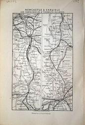 Newcastle & Carlisle and North-Shields & Tynemouth Railways J Bartholomew 1883 - 8.5 x 14 cm For A & C Black's Guide to England & Wales Larger image Ref uk1183 : £3 Return to Great Britain & Ireland Index |
 North & South Wales John Cary 1792 - 10.5 x 16 cm Antique double sided maps from The Traveller's Companion, with original fine hand colouring. Note the stain on North Wales No Larger Image Ref uk1852 : £12 Return to Great Britain & Ireland Index |
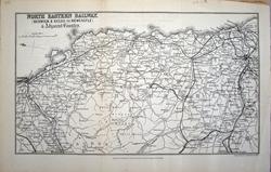 North Eastern Railway: Berwick & Kelso to Newcastle & Adjacent Country J Bartholomew 1883 - 25.5 x 15 cm For A & C Black's Guide to England & Wales. Two folds Larger image Ref uk1190 : £8 Return to Great Britain & Ireland Index |
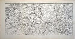 North Eastern Railway: Newcastle to York, with the connecting lines & Adjacent Country J Bartholomew 1883 - 31 x 15 cm For A & C Black's Guide to England & Wales. Three folds Larger image Ref uk1189 : £8 Return to Great Britain & Ireland Index |
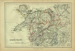 North Wales Charles Knight 1852 - 23 x 16 cm Original fine outline colouring. Many railway lines. Larger image Ref uk215 : £12 Return to Great Britain & Ireland Index |
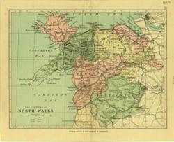 North Wales Geo. Philip & Son 1889 - 20 x 15 cm Printed colour counties. Large number of railway lines. Larger image Ref uk119 : £7 Return to Great Britain & Ireland Index |
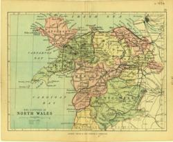 North Wales Geo. Philip & Son 1880 - 20 x 15 cm Printed colour counties. Large number of railway lines. Larger image Ref uk120 : £6 Return to Great Britain & Ireland Index |
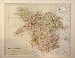 North Wales Hughes for Virtue & Co. 1868 - 30 x 24 cm Colour printed map of the Counties, showing roads and railways. Larger image Ref uk733 : £5 Return to Great Britain & Ireland Index |
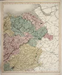 North Wales Longman, Rees, Orme 1837 - 32 x 39 cm Original wash hand-colouring of the Counties and Boroughs. Good margins all round. As J & C Walker's maps but without the ascription. A very pretty map. Larger image Ref uk190 : £32 Return to Great Britain & Ireland Index |
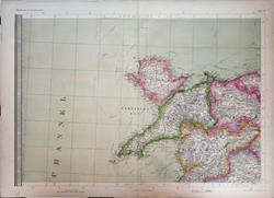 North Wales. The Imperial Map of England & Wales. John Bartholomew, F.R.G.S. A Fullarton & Co. London & Edinburgh. 1868 - 69 x 49.5 cm Original antique map with original hand colouring of the county boundaries as issued. The Imperial Map of England & Wales according to the Ordnance Survey, with the latest additions; shewing clearly every feature of the country, railways and their stations, Roads, Canals, Rivers, Gentlemen's Seats, &c. &c. On the Scale of 4 Miles to an Inch. Larger image 1 : Larger Image 2 Ref uk1728 : £22 Return to Great Britain & Ireland Index |
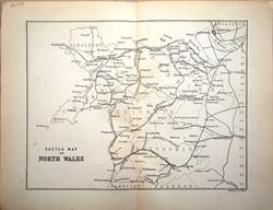 North Wales: Sketch Map J Bartholomew 1883 - 19 x 14 cm For A & C Black's Guide to England & Wales; centrefold Larger image Ref uk1197 : £4 Return to Great Britain & Ireland Index |
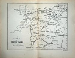 North Wales: Sketch Map J Bartholomew 1874 - 19 x 14.5 cm For A & C Black's Guide to England & Wales; centrefold Larger image Ref uk1597 : £7 Return to Great Britain & Ireland Index |
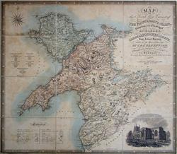 North West Circuit of the Principality of Wales Greenwood, C & J 1834 - 69 x 63.5 cm The map depicts Anglesea, Caernarfon and Merioneth and also includes a decorative title cartouche, compass rose, Explanation and Reference to the Polling Places as well as a very fine engraving of Bangor Cathedral. Overall 690 x 635mm. Published April 1st 1834. Hand coloured as issued, dissected and laid down on heavy board. In good condition but some toning in the uncoloured areas. Because of its size shipping will be £10 in the UK. Larger image 1 : Larger Image 2 : Larger Image 3 : Larger Image 4 Ref uk1228 : £40 Return to Great Britain & Ireland Index |
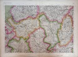 North West England & North Midlands as far south as Nottinghamshire & N. Leicestershire. The Imperial Map of England & Wales. John Bartholomew, F.R.G.S. A Fullarton & Co. London & Edinburgh. 1868 - 69 x 49.5 cm Original antique map with original hand colouring of the county boundaries as issued. The Imperial Map of England & Wales according to the Ordnance Survey, with the latest additions; shewing clearly every feature of the country, railways and their stations, Roads, Canals, Rivers, Gentlemen's Seats, &c. &c. On the Scale of 4 Miles to an Inch. Larger image 1 : Larger Image 2 Ref uk1727 : £25 Return to Great Britain & Ireland Index |
> Section 1 > Section 2 > Section 3 | |||