| Home Page | Buying | Maps | Books | Prints | Ephemera |
- Home Page
- England & Wales County Maps Anglesea - Dorset
- England & Wales County Maps Durham - Merioneth
- England & Wales County Maps Midd'x - Somerset
- England & Wales County Maps Staffs - Yorks
- British Isles: Physical, Railways, Statistical, etc. Roman Britain
- England & Wales, Countries, Islands, Regions inc. the Lake District, Road & Rail Maps
- Scotland, the Country & Regions: Town Plans & Environs; Rail Maps
- Ireland, the Country, Regions & Environs
- England & Wales, Town Plans & Maps of Environs
- Ordnance Survey and Folding Maps

There are 10 pages of maps of the British Isles. Please see the index on the Great Britain page to gain access to 1000 maps of England, Wales, Scotland and Ireland.
All our maps are Originals, NOT modern reproductions and have thumbnails as well as larger images so it is easy to find what you are looking for.
If you want several items, email me for a discount!
Email: don@theoldmapman.com
> Section 1 > Section 2
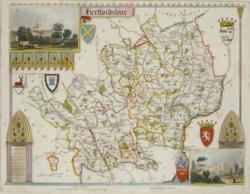 Hertfordshire Thomas Moule 1850 - 26 x 20 cm Good margins (for a Thomas Moule!) on this map which is quite brightly hand-coloured. Vignettes of St Alban's Abbey and Cashiobury. A little light foxing. (See image) Larger image Ref uk754 : £32 Return to Great Britain & Ireland Index |
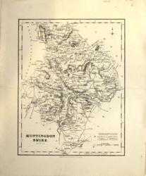 Huntingdonshire Arch'd Fullarton c1845 - 19 x 24 cm Uncoloured map. No railways. Details of hills and woodlands Larger image Ref uk356 : £7 Return to Great Britain & Ireland Index |
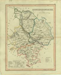 Huntingdonshire Archer 1840 - 18 x 24 cm Original wash colouring border with fine outline colouring of the hundreds. Larger image Ref uk139 : £7 Return to Great Britain & Ireland Index |
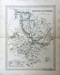 Huntingdonshire Archer for Dugdale c1850 - 18 x 24 cm Very fine original outline hand colouring of the County and Hundred boundaries as well as the railways which are a feature of these attractive maps. Centrefold as issued. Very good condition. Larger image Ref uk1751 : £8 Return to Great Britain & Ireland Index |
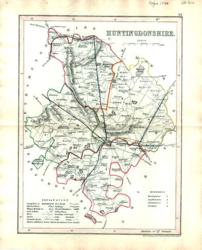 Huntingdonshire Archer for Dugdale 1850 - 18 x 24 cm Very fine outline hand colouring of the County and Hundred boundaries as well as the railways which are a feature of these attractive maps Larger image Ref uk314 : £6 Return to Great Britain & Ireland Index |
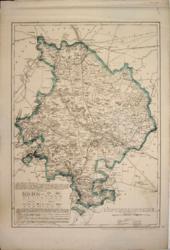 Huntingdonshire Cassell, Petter & Galpin 1862 - 31 x 42 cm Original outline colour. A large map by John Dower. Creasing of the top margin area. Larger image Ref uk196 : £10 Return to Great Britain & Ireland Index |
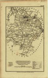 Huntingdonshire G & W B Whittaker 1824 - 11 x 18 cm Uncoloured detailed map in which is laid down every Parish & Place containing upwards of 20 houses; table of information on the county. Nice copy Larger image Ref uk028 : £7 Return to Great Britain & Ireland Index |
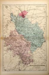 Huntingdonshire G W Bacon 1887 - 31 x 46 cm Large double page hand coloured map as issued with woods, parks, hills, roads and railways. The railway companies are named on each line. Has been repaired on the front with transparent water based tape on LHS at the centrefold, just covering the border. Larger image Ref uk493 : £3 Return to Great Britain & Ireland Index |
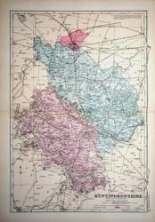 Huntingdonshire G W Bacon c 1885 - 31 x 46 cm Large double page hand coloured map as issued showing woods, parks, hills, roads and railways together with towns, villages and hamlets and even individual properties. The railway network is very clearly shown and the railway companies are named on each line. A very attractive map in fine condition. Larger image Ref uk940 : £10 Return to Great Britain & Ireland Index |
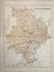 Huntingdonshire Hughes for Virtue & Co. 1868 - 24 x 31 cm Colour printed map of the county showing roads and railways. Centrefold strengthened. Larger image Ref uk418 : £4 Return to Great Britain & Ireland Index |
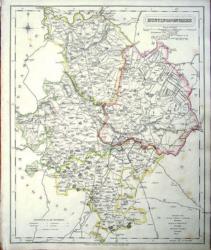 Huntingdonshire J & C Walker 1837 - 32 x 39 cm Fine original hand colouring of the hundreds and the county boundaries. Offered at reduced price because the item shows some foxing. (See image). Larger image Ref uk845 : £12 Return to Great Britain & Ireland Index |
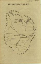 Huntingdonshire John Aikin 1809 - 10 x 15 cm Simple map showing county outline, rivers and some towns Larger image Ref uk016 : £5 Return to Great Britain & Ireland Index |
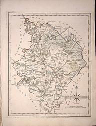 Huntingdonshire John Cary 1787 - 21 x 27 cm Antique map with original hand colouring of roads, woodland and the county boundaries. One margin is a little narrower than usual, (see image). Supplied with a separate sheet describing the county and its industry, farming, gentry and environment, together with a list of the country seats and The most remarkable Places for extensive Prospects, etc. Larger image Ref uk1286 : £23 Return to Great Britain & Ireland Index |
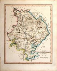 Huntingdonshire John Cary 1821 - 21 x 27 cm The very finest quality original hand colouring of roads, woodland and the county boundaries. Supplied with a separate sheet describing the county and its industry, farming, gentry and environment, together with a list of the country seats and The most remarkable Places for extensive Prospects, etc. Larger image Ref uk267 : £19 Return to Great Britain & Ireland Index |
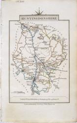 Huntingdonshire John Cary 1822 - 9 x 14 cm Original hand colouring of roads, woodland and the county boundaries. Larger image Ref uk803 : £14 Return to Great Britain & Ireland Index |
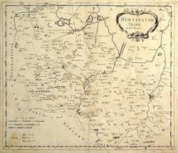 Huntingdonshire Morden 1695/1772 - 42 x 36 cm Uncoloured map with narrow but adequate margins all round. Lower centrefold strengthened. A good impression. Larger image Ref uk155 : £40 Return to Great Britain & Ireland Index |
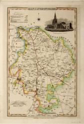 Huntingdonshire Pigot & Co 1826/31 - 22 x 36 cm Original hand coloured outline with parks in green. Vignette of Godmanchester Church. A nice copy, Larger image Ref uk179 : £25 Return to Great Britain & Ireland Index |
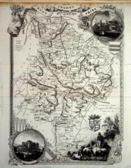 Huntingdonshire Thomas Moule c1845 - 28 x 22 cm Decorative map with vignettes and coats of arms. Uncoloured as issued. As is often the case with these maps there are several original folds and the engraving reaches an edge of the sheet where an old paper extension will make fitting it to a mount easier. Another edge is strengthened. Several railways are shown. Larger image Ref uk1052 : £10 Return to Great Britain & Ireland Index |
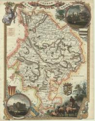 Huntingdonshire Thomas Moule 1850 - 20 x 27 cm Hand-coloured with engraved border with shields, farmer on horseback with cattle and views of country seats. No top or bottom margin Larger image Ref uk151 : £21 Return to Great Britain & Ireland Index |
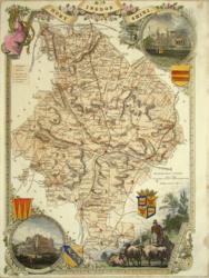 Huntingdonshire Thomas Moule c 1845 - 20 x 27 cm Decorative map with vignettes and coats of arms. Rather bold hand colouring. As usual with this county the engraving reaches to three edges of the sheet. Larger image Ref uk747 : £21 Return to Great Britain & Ireland Index |
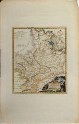 Huntingdonshire Thos Kitchin c 1780 - 18 x 22 cm Hand-coloured map with cartouche in the form of a grave stone surrounded by roses with a basket of apples. Folio paper with a tiny hole that does not cause any loss to the print and has been neatly repaired. Larger image Ref uk154 : £39 Return to Great Britain & Ireland Index |
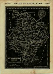 Huntingdonshire W Edwards 1833 - 23 x 17 cm White on Black with Coat of Arms From Guide to Knowledge. With hunting medallion. Larger image Ref uk006 : £6 Return to Great Britain & Ireland Index |
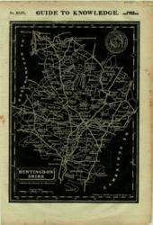 Huntingdonshire W Edwards 1833 - 23 x 17 cm White on Black with Coat of Arms From Guide to Knowledge. With hunting medallion. Larger image Ref uk007 : £4 Return to Great Britain & Ireland Index |
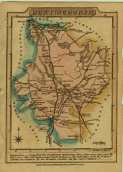 Huntingdonshire Wallis 1820 - 9 x 13 cm Original wash colouring Larger image Ref uk045 : £10 Return to Great Britain & Ireland Index |
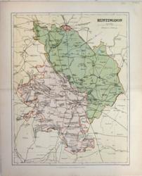 Huntingdonshire Weller for MacKenzie 1894 - 22 x 28 cm High quality colour printed map of the county, on good paper, showing roads and railways and parliamentary divisions. Larger image Ref uk454 : £5 Return to Great Britain & Ireland Index |
 Huntingdonshire & Kent John Cary 1792 - 10.5 x 16 cm Antique double sided maps from The Traveller's Companion, with original fine hand colouring of boundaries, roads, towns & parks. Larger image 1 : Larger Image 2 Ref uk1840 : £20 Return to Great Britain & Ireland Index |
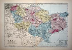 Kent G W Bacon c 1885 - 45 x 30 cm Large double page hand coloured map as issued showing woods, parks, hills, roads and railways together with towns, villages and hamlets and even individual properties. The railway network is very clearly shown and the railway companies are named on each line. A very attractive map in very good condition. (Very short crease at foot of centrefold) Larger image Ref uk941 : £16 Return to Great Britain & Ireland Index |
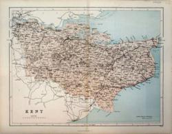 Kent Hughes for Virtue & Co. 1868 - 31 x 23 cm Colour printed map of the county showing roads and railways. Evidence of tracing outline only visible from the back. Larger image Ref uk420 : £5 Return to Great Britain & Ireland Index |
 Kent J & C Walker 1836 - 41 x 33 cm Original wash hand-colouring of the Divisions, Hundreds and Boroughs. A fine map. Larger image Ref uk185 : £38 Return to Great Britain & Ireland Index |
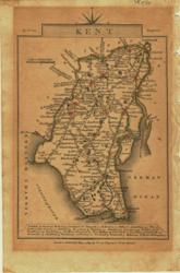 Kent John Cary 1819 - 9 x 15 cm Original outline colouring inc some roads, woods and towns. Paper has toned markedly but the colour of the towns and woods remains bright. Larger image Ref uk554 : £6 Return to Great Britain & Ireland Index |
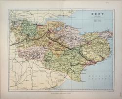 Kent Weller for MacKenzie 1894 - 28 x 22 cm High quality colour printed map of the county, on good paper, showing roads and railways and parliamentary divisions. Larger image Ref uk455 : £9 Return to Great Britain & Ireland Index |
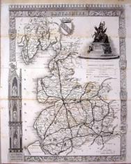 Lancashire Thomas Moule c1845 - 28 x 22 cm Decorative map with vignettes and coats of arms. Uncoloured as issued. As is often the case with these maps there are several original folds, one of which is strengthened, and the engraving reaches almost to an edge of the sheet where an old paper extension will make fitting it to a mount easier. Some light foxing along folds (see image). This county has a large number of railways shown. Larger image Ref uk1056 : £10 Return to Great Britain & Ireland Index |
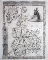 Lancashire Thomas Moule c1845 - 28 x 22 cm Decorative map with vignettes and coats of arms. Uncoloured as issued. Single original fold. Very good margins for a Thomas Moule. Several railways are shown. Larger image Ref uk1092 : £20 Return to Great Britain & Ireland Index |
 Lancashire & Leicestershire John Cary 1792 - 10.5 x 16 cm Antique double sided maps from The Traveller's Companion, with original fine hand colouring of boundaries, roads, towns & parks. Larger image 1 : Larger Image 2 Ref uk1841 : £16 Return to Great Britain & Ireland Index |
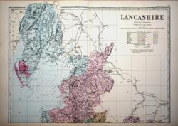 Lancashire North G W Bacon c 1885 - 46 x 33 cm Large double page hand coloured map as issued showing woods, parks, hills, roads and railways together with towns, villages and hamlets and even individual properties. The railway network is very clearly shown and the railway companies are named on each line. A very attractive map in fine condition. Larger image Ref uk942 : £14 Return to Great Britain & Ireland Index |
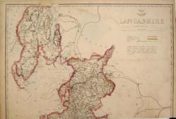 Lancashire, North Edward Weller 1858 - 46 x 31 cm Original outline colour. A large map for the Weekly Dispatch Atlas. This has been trimmed at the bottom inside the engraved area but reaches as far South as Fleetwood. At this time the county included what is now part of Cumbria from Ambleside to Barrow and Walney Island and Cartmell. Central East West crease. Priced to recognise its truncation and condition. Larger image Ref uk197 : £3 Return to Great Britain & Ireland Index |
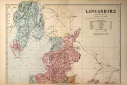 Lancashire: 2 sheets G W Bacon 1881 - 46 x 65 cm Large double page hand coloured map as issued with woods, parks, hills, roads and railways. The railway companies are named on each line. Mount together to form one large map. Very bottom margin just a trifle nibbled but a good copy. Two images available. Larger image 1 : Larger Image 2 Ref uk496 : £15 Return to Great Britain & Ireland Index |
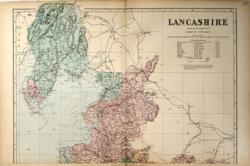 Lancashire: 2 sheets G W Bacon 1887 - 46 x 65 cm Large double page hand coloured map as issued with woods, parks, hills, roads and railways. The railway companies are named on each line. Mount together to form one large map. A good copy. Two images available. Larger image 1 : Larger Image 2 Ref uk497 : £15 Return to Great Britain & Ireland Index |
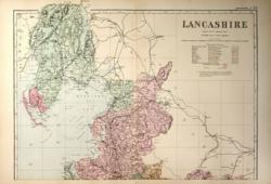 Lancashire: 2 sheets G W Bacon 1890 - 46 x 65 cm Large double page hand coloured map as issued with woods, parks, hills, roads and railways. The railway companies are named on each line. Mount together to form one large map. A fine copy. Two images available. Larger image 1 : Larger Image 2 Ref uk498 : £15 Return to Great Britain & Ireland Index |
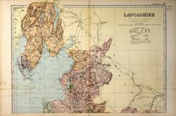 Lancashire: 2 sheets G W Bacon 1897 - 46 x 65 cm Large double page coloured map with woods, parks, hills, roads and railways. The railway companies are named on each line. Mount together to form one large map. Some foxing on the Irish Sea on Northern sheet and the Southern sheet has a strengthened or repaired centrefold. Two images available. Larger image 1 : Larger Image 2 Ref uk499 : £12 Return to Great Britain & Ireland Index |
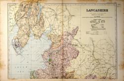 Lancashire: 2 sheets G W Bacon 1898 - 46 x 65 cm Large double page coloured map with woods, parks, hills, roads and railways. The railway companies are named on each line. Mount together to form one large map. Some foxing in the margins but not affecting the county area. Two images available. Larger image 1 : Larger Image 2 Ref uk500 : £10 Return to Great Britain & Ireland Index |
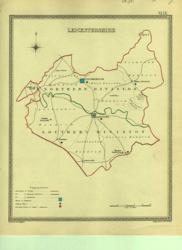 Leicester Creighton; J&C Walker 1835 - 19 x 24 cm Parliamentary boundary map showing polling places and Borough Towns with the number of members to be returned from each. County and electoral boundaries shown in original outline hand colouring. Larger image Ref uk381 : £7 Return to Great Britain & Ireland Index |
 Leicestershire Hughes for Virtue & Co. 1868 - 25 x 30 cm Colour printed map of the county showing roads and railways. Centrefold repaired at RHS. Marginal pencil notes erased. Larger image Ref uk421 : £4 Return to Great Britain & Ireland Index |
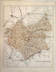 Leicestershire Hughes for Virtue & Co. 1868 - 25 x 30 cm Colour printed map of the county showing roads and railways. Centrefold repaired. Marginal tear repaired. Larger image Ref uk422 : £5 Return to Great Britain & Ireland Index |
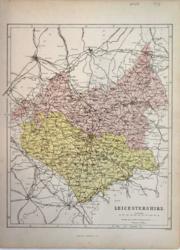 Leicestershire Hughes for Virtue & Co. 1873 - 25 x 30 cm Colour printed map of the county showing roads and railways. The Divisions in different colours. Unfolded. Larger image Ref uk423 : £6 Return to Great Britain & Ireland Index |
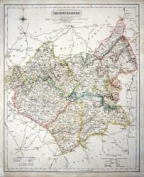 Leicestershire J & C Walker 1837 - 32 x 39 cm Fine original hand colouring of the hundreds and the county boundaries. Good condition. See the image. Shows the Leicester and Swannington Railroad. Larger image Ref uk848 : £22 Return to Great Britain & Ireland Index |
 Leicestershire John Aikin 1809 - 10 x 15 cm Simple map showing county outline, rivers and some towns. Some offsetting Larger image Ref uk017 : £4 Return to Great Britain & Ireland Index |
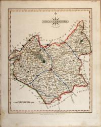 Leicestershire John Cary 1821 - 21 x 27 cm The very finest quality original hand colouring of roads, woodland and the county boundaries. Supplied with a separate sheet describing the county and its industry, farming, gentry and environment, together with a list of the country seats and The most remarkable Places for extensive Prospects, etc. Larger image Ref uk270 : £28 Return to Great Britain & Ireland Index |
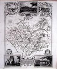 Leicestershire Thomas Moule c1845 - 28 x 22 cm Decorative map with vignettes and coats of arms. Uncoloured as issued. As is often the case with these maps there are several original folds and the engraving reaches an edge of the sheet where an old paper extension will make fitting it to a mount easier. Several railways are shown. Larger image Ref uk1057 : £12 Return to Great Britain & Ireland Index |
 Leicestershire W Edwards 1833 - 23 x 17 cm White on Black with Coat of Arms From Guide to Knowledge. With Coat of Arms. Larger image Ref uk008 : £6 Return to Great Britain & Ireland Index |
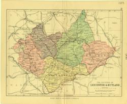 Leicestershire & Rutland Geo. Philip & Son 1889 - 20 x 15 cm Printed colour hundreds. Large number of railway lines. Larger image Ref uk092 : £7 Return to Great Britain & Ireland Index |
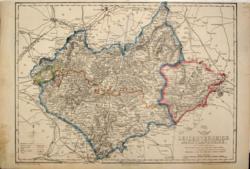 Leicestershire & Rutland John Dower 1858 - 43 x 31 cm Original outline colour. A large map. This has been trimmed close to the engraved area at the top. One edge strengthened. Central East West crease. Day & Son lithographed for the Weekly Dispatch Atlas. Larger image Ref uk199 : £12 Return to Great Britain & Ireland Index |
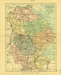 Lincolnshire Geo. Philip & Son 1889 - 15 x 21 cm Printed colour hundreds. Large number of railway lines. Larger image Ref uk093 : £7 Return to Great Britain & Ireland Index |
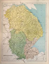 Lincolnshire Hughes for Virtue & Co. 1873 - 24 x 33 cm Colour printed map of the county showing roads and railways. The Divisions in different colours. Centrefold strengthened. Larger image Ref uk424 : £6 Return to Great Britain & Ireland Index |
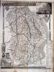 Lincolnshire Thomas Moule c1845 - 28 x 22 cm Decorative map with vignettes and coats of arms. Uncoloured as issued. As is often the case with these maps there are several original folds and the engraving reaches an edge of the sheet where an old paper extension will make fitting it to a mount easier. Several railways are shown. Larger image Ref uk1058 : £10 Return to Great Britain & Ireland Index |
 Lincolnshire & Middlesex John Cary 1792 - 10.5 x 16 cm Antique double sided maps from The Traveller's Companion, with original fine hand colouring of boundaries, roads, towns & parks. Larger image 1 : Larger Image 2 Ref uk1842 : £16 Return to Great Britain & Ireland Index |
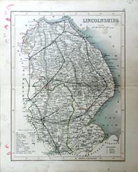 Lincolnshire. Archer for Dugdale c1850 - 24 x 18 cm Very fine original outline hand colouring of the County and Hundred boundaries as well as the railways which are a feature of these attractive maps. Centrefold as issued. Fair condition because of crayon scribbles in the margin and two smudges in the North Sea. However with a tight mount to the engraved frame would look pretty good. Larger image Ref uk1754 : £4 Return to Great Britain & Ireland Index |
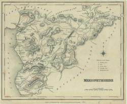 Merionethshire J & C Walker / Lewis 1842 - 24 x 19 cm Uncoloured map. Narrow margins. Larger image Ref uk370 : £4 Return to Great Britain & Ireland Index |
||
> Section 1 > Section 2 | |||