| Home Page | Buying | Maps | Books | Prints | Ephemera |
- Home Page
- North America
- Central America and West Indies
- South America

1,500 maps reduced in price
All our maps are Originals, NOT modern reproductions
Now all our maps have thumbnails as well as larger images so finding what you want is quicker.
If you want several items, email me for a discount!
Email: don@theoldmapman.com
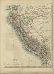 Bolivia. Verso: Peru. W & A K Johnston 1896 - 20 x 26 cm Fine detailed maps of both these countries which are each shown with larger territories than they now control. Outline Colouring. Two images available. Larger image 1 : Larger Image 2 Ref sam17 : £9 Return to America Index |
 Chile Bartholomew 1885 - 24 x 14 cm Coloured map of the whole country in three sections, according to Admiralty Surveys, United States Expeditions, Gaye, Philippi, Pissis, &c. Larger image Ref sam04 : £8 Return to America Index |
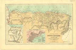 Dutch Guayana Bartholomew 1885 - 23 x 14 cm Coloured map of the colonised portion of the Country with a sketch map of the Extent of the Colony and a Plan of Valparaiso. Larger image Ref sam03 : £8 Return to America Index |
 East Coast of Brazil Bartholomew 1885 - 14 x 23 cm Coloured map of Bahia, Sergipe, Alagoas and part of Pernambuco, showing the Bahia & San Francisco Railway Larger image Ref sam05 : £8 Return to America Index |
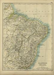 Eastern Brazil. Verso: Chile. W & A K Johnston 1896 - 20 x 26 cm Eastern Brazil as far as the start of the Matto Grosso. Double column map of Chile with a mass of detail especially about the coast and the islands making up the Southern border with the Pacific Ocean. Outline Colouring. Two images available. Larger image 1 : Larger Image 2 Ref sam18 : £9 Return to America Index |
 Peru. Verso: Bolivia W & A K Johnston 1897 - 20 x 26 cm Fine detailed maps of both these countries which are each shown with larger territories than they now control. Outline Colouring. Two images available. Larger image 1 : Larger Image 2 Ref sam12 : £9 Return to America Index |
 Plans & Environs of S. American Cities. Verso: Central America W & A K Johnston 1897 - 26 x 21 cm Valparaiso, Buenos Aires, Rio de Janeiro, La Plata & Galapagos Islands. Printed outline colour. Verso: Central America showing the relation of Panama and Nicaragua Canals, with insets of Nicaragua Canal; Lima, Callao & environs; Panama Canal. A striking item. Two images available. Larger image 1 : Larger Image 2 Ref sam09 : £11 Return to America Index |
 South America Anon c 1875 - 24 x 29 cm Good clean and clear coloured map of the whole sub-continent. Full of detail of the towns. Larger image Ref sam20 : £8 Return to America Index |
 South America Bartholomew/ A&C Black 1873 - 42 x 55 cm A large coloured map of the whole sub-continent. La Plata also given title of Argentine Republic but Patagonia still shown as separate. Colombia is described as New Granada. A Handsome and clean map. Larger image Ref sam28 : £14 Return to America Index |
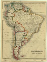 South America Dower 1868 - 18 x 25 cm Outline colouring to the countries; V sl shaved RHS Larger image Ref sam02 : £10 Return to America Index |
 South America Ed. Stanford 1882 - 26 x 34 cm A fine map of the sub-continent with good block colouring. Especially detailed along the coasts. Ecuador's boundaries in particular are very different to the modern ones. One or two scuffs on the ocean. Larger image Ref sam24 : £12 Return to America Index |
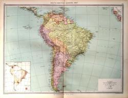 South America Geo. Philip c1907 - 48 x 35 cm Very large coloured political map of the continent with an inset showing population density. Larger image Ref sam40 : £9 Return to America Index |
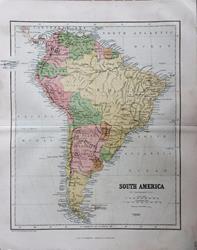 South America J Bartholomew for W & R Chambers c1868 - 26 x 22.5 cm Original antique coloured map. Centrefold as issued. Especially nice colouring. Larger image Ref sam52 : £9 Return to America Index |
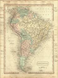 South America Longman/Hall 1851 - 21 x 26 cm Original wash hand colouring of the countries of the sub-continent. Just a little light foxing, principally outside the printed area. Surrounding the map are list of the heights of mountains and lengths of rivers. Larger image Ref sam08 : £12 Return to America Index |
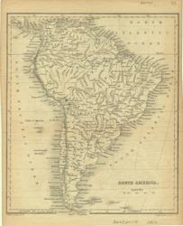 South America Longman/S.Hall 1854 - 16 x 18 cm Uncoloured map of the sub-continent, from Goldsmith's Geography. Most of the towns are on the coast with apparently little development inland indicated. Larger image Ref sam01 : £8 Return to America Index |
 South America S.Hall/Longman, Hurst, Rees, Orme & Brown 1822 - 19 x 25 cm Original simple outline hand colouring of the sub-continent. Just a little offsetting in the southern oceans. Larger image Ref sam07 : £12 Return to America Index |
 South America Wm. Blackwood 1852 - 24 x 31 cm A map concentrating on the rivers of the sub-continent. Shows Colombia as New Granada. Block colouring. A few small marks on the oceans. Larger image Ref sam23 : £6 Return to America Index |
 South America Wm. MacKenzie c1885 - 22 x 27.5 cm Original antique coloured map. Centrefold as issued. Larger image Ref sam51 : £8 Return to America Index |
 South America (Northern Sheet) Keith Johnston 1877 - 60 x 44 cm South as far as 20 degree S. Amazingly detailed river mapping. Inset of the Galapagos Islands. Fine outline colouring designed to look like hand colouring. Good condition. Larger image Ref sam32 : £15 Return to America Index |
 South America (Northern Sheet) W & A K Johnston 1881 - 60 x 44 cm South as far as 20 degree S. Amazingly detailed river mapping. Inset of the Galapagos Islands. Fine outline colouring designed to look like hand colouring. Fore edges strengthened and a slight crease but the map in good condition. Larger image Ref sam26 : £15 Return to America Index |
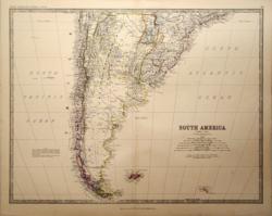 South America (Southern Sheet) Keith Johnston 1877 - 57 x 44 cm From the Argentine and Paraguay South. A great amount of detail especially in Chile. With a note about the territorial claims of Chile and the Argentine. Fine outline colouring designed to look like hand colouring. Very good condition. Larger image Ref sam33 : £15 Return to America Index |
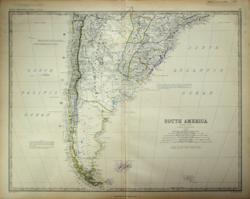 South America (Southern Sheet) Keith Johnston 1861 - 57 x 45 cm From the Argentine and Paraguay South. A great amount of detail especially in Chile. With a note about the territorial claims of Chile and the Argentine and two other notes on the Argentine boundaries. Notes on navigation up half a dozen rivers and a note on a proposal (1860) for a 1,000 mile railway climbing to 16,000 feet from the Chilean coast to Rosario not far from Rio de Janeiro on the R.Parana. Superb hand-colouring in outline as issued makes this a beautiful map which is in very good condition. Larger image Ref sam35 : £25 Return to America Index |
 South America (Southern Sheet) W & A K Johnston 1881 - 57 x 44 cm From the Argentine and Paraguay South. A great amount of detail especially in Chile. Fine outline colouring designed to look like hand colouring. Fore edges strengthened, upper and lower centrefold repaired and some creasing in the Atlantic with scuff mark at foot in the Pacific. Larger image Ref sam27 : £8 Return to America Index |
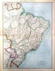 South America, North East Geo. Philip c1907 - 35 x 48 cm Very large and detailed coloured map of Brazil, Paraguay and the Guianas with an area of the Matto Grosso marked "unexplored". Larger image Ref sam43 : £12 Return to America Index |
 South America, North West Geo. Philip c1907 - 35 x 48 cm Very large and detailed coloured map of Antofagasta to Panama and Barbados, the Amazonas and the Matto Grosso. Railways shown. Inset of the Galapagos Isles. Larger image Ref sam42 : £12 Return to America Index |
 South America, North West. Verso: South America Bartholomew c 1895 - 17 x 24 cm Coloured map of Northern Bolivia to British Guiana. Peru, Ecuador, Colombia and Western Brazil. Insets of Panama after the first French attempt to build the canal and about the time of their second attempt, started in 1894. Small inset of Sabanilla. Verso: South America with the countries outlined in colour. Along with two sections across the continent. Some faint foxing on Ocean and on the insets. Two images available. Larger image 1 : Larger Image 2 Ref sam37 : £9 Return to America Index |
 South America, South Geo. Philip c1907 - 35 x 48 cm Very large coloured map of the Southern continent from the North to the South of Chile. Large inset showing detail of Central Chile on a scale three times larger. Also covers Argentina showing its Territories and Uruguay, Paraguay and Southern Brazil. Larger image Ref sam44 : £12 Return to America Index |
 South America, The South. Verso: South America, North East Bartholomew c 1895 - 17 x 24 cm Coloured map of Southern Bolivia to Tierra del Fuego with inset of the Falkland Is. Verso: The Guianas to Porto Alegre including Paraguay and the larger part of Brazil. Inset of the environs of Rio. Some faint foxing, verso. Two images available. Larger image 1 : Larger Image 2 Ref sam38 : £11 Return to America Index |
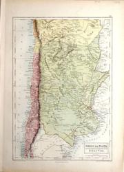 South America, West S.Hall/ A&C Black 1873 - 26 x 37 cm Chili (sic), North; La Plata or the Argentine Republic; Bolivia, South. Patagonia is described as inhabited by wandering tribes of Indians. A large coloured map, especially of La Plata, in good condition. Larger image Ref sam30 : £12 Return to America Index |
 South America. J Bartholomew 1859 - 42 x 55 cm A large coloured map of the whole sub-continent. La Plata also given title of Argentine Republic but Patagonia still shown as separate. Colombia is described as New Granada. A Handsome and clean map but there is a short closed split on the centrefold right border. Larger image Ref sam45 : £10 Return to America Index |
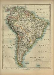 South America: Verso: S America, Physical W & A K Johnston 1897 - 20 x 26 cm A clear map of the whole sub-continent with indications of the latitude or longitude of world cities. Outline Colouring Larger image Ref sam10 : £7 Return to America Index |
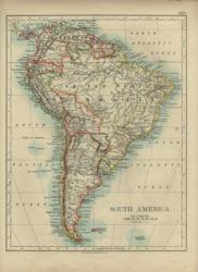 South America: Verso: S America, Physical W & A K Johnston 1896 - 20 x 26 cm A clear map of the whole sub-continent with indications of the latitude or longitude of world cities. Outline Colouring Larger image Ref sam15 : £7 Return to America Index |
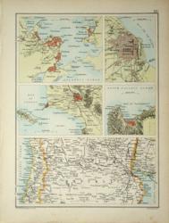 The Pampas and four cities. Verso: Australasia Bartholomew c 1895 - 17 x 24 cm Coloured map of Santiago to Montevideo. Environs of Rio, Buenos Ayres, Lima and Valparaiso. Verso: Australasia; a nice coloured map from Java to Santa Cruz and New Zealand with Australia divided into Territories including the Northern Territory of South Australia. Two images available. Larger image 1 : Larger Image 2 Ref sam39 : £10 Return to America Index |
 Uruguay, Paraguay & North Argentina. Verso: South Argentina. W & A K Johnston 1897 - 26 x 20 cm Uruguay, Paraguay and North Argentina. Verso: South Argentina, from Concepcion to Staten Is and Cape Horn with the Falkland Is. Good Outline Colouring. Two images available. Larger image 1 : Larger Image 2 Ref sam19 : £11 Return to America Index |
||
| |||