| Home Page | Buying | Maps | Books | Prints | Ephemera |
- Home Page
- North America
- Central America and West Indies
- South America

Lots of new maps added to the North American pages
All our maps are Originals, NOT modern reproductions
Now all our maps have thumbnails as well as larger images so finding what you want is quicker.
If you want several items, email me for a discount!
Email: don@theoldmapman.com
> Section 1 > Section 2
 Canada. Ed. Stanford 1882 - 33 x 26 cm From the Parry Islands in the North to New York in the South. Solid colouring, with some by hand. Marginal repair at base. Larger image Ref nam34 : £18 Return to America Index |
 Canada. Geo. Philip c1907 - 48 x 35 cm Very large coloured general map of Canada as far North as Ellesmere Island, with an inset of the Klondike. The map also shows the source of products including Petroleum, Seals, Asbestos, Lobster, Sturgeon and Gold. Larger image Ref nam63 : £14 Return to America Index |
 Canada. Western Canada Geo. Philip c1907 - 48 x 35 cm Very large coloured map of British Columbia and Alberta as far North as the 57th Parallel. An impressive map, especially of the Coastline and Vancouver Island. Stain in lower corners of margin (see image). Larger image Ref nam59a : £12 Return to America Index |
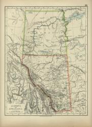 Canada: Alberta and Athabasca. Verso: United States. W & A K Johnston 1897 - 20 x 26 cm This is the modern Alberta. Verso: A nice map of the U.S. with clear outline colouring of the individual States. Two images available. Larger image 1 : Larger Image 2 Ref nam30 : £10 Return to America Index |
 Canada: British Columbia and part of North West Territory. Verso: Manitoba and part of North West Territory. Bartholomew c 1895 - 24 x 17 cm British Columbia, Athabasca and Alberta. Interesting coloured map with two railroads. Verso: Central Canada; Assiniboia, Saskatchewan, Manitoba and Ontario North to the 58th parallel. Two images available. Larger image 1 : Larger Image 2 Ref nam48 : £10 Return to America Index |
 Canada: British Columbia, Athabasca and Alberta. Adam and Charles Black's General Atlas of the World. 1895 - 27 x 39.5 cm Large coloured map, elegantly coloured in outline. Larger image Ref nam131 : £11 Return to America Index |
 Canada: Central Canada Geo. Philip c1907 - 48 x 35 cm Very large coloured map of Saskatchewan, Manitoba and Ontario with a corner of Keewatin. The railways are clearly shown. Larger image Ref nam60 : £12 Return to America Index |
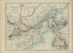 Canada: East and Newfoundland. Verso: British North America W & A K Johnston 1896 - 26 x 20 cm From Lake Superior to Cape Breton Island with Newfoundland in an inset on the same scale. Verso: British North America, from Banks Strait and North Devon to Lake Erie in the South. Outline Colouring. Two images available. Larger image 1 : Larger Image 2 Ref nam25 : £9 Return to America Index |
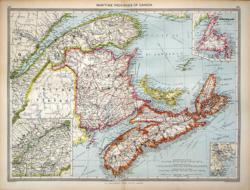 Canada: Maritime Provinces of Canada and Newfoundland Geo. Philip c1907 - 48 x 35 cm Very large coloured map of Quebec West from the City of Quebec to include Nova Scotia and Cape Breton Island. Inset of Newfoundland and of the area from Montreal to Quebec. A further inset covers the environs of Halifax. Larger image Ref nam62 : £12 Return to America Index |
 Canada: New Brunswick, Nova Scotia and Newfoundland. Verso: Ontario. W & A K Johnston 1897 - 26 x 20 cm A clear map of these provinces divided into counties with Newfoundland in an inset on one third scale. Verso: Ontario, but this is just a small portion of the modern Ontario. There is an inset with its Western portion at a smaller scale. Outline Colouring. Two images available. Larger image 1 : Larger Image 2 Ref nam28 : £10 Return to America Index |
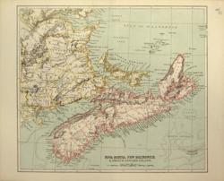 Canada: New Brunswick, Nova Scotia and Prince Edward Is. Anon 1886 - 28 x 24 cm Especially detailed map of the coast-lines. Printed outline colour. A good looking map. Marginal repair at side Larger image Ref nam32 : £15 Return to America Index |
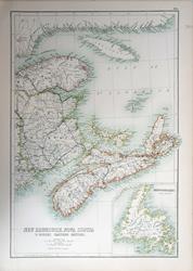 Canada: New Brunswick, Nova Scotia, & Quebec, Eastern Section. Adam and Charles Black's General Atlas of the World. 1895 - 28 x 41 cm Large coloured map, elegantly coloured in outline. Larger image Ref nam133 : £11 Return to America Index |
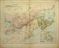 Canada: New Brunswick, Nova Scotia, &c. George Philip 1865 - 30 x 23 cm … with an inset of Newfoundland. The Eastern boundary from St Paul's to Dallas. Printed Colour. Small faint mark near Rhode Island. Larger image Ref nam02 : £7 Return to America Index |
 Canada: New Brunswick, Nova Scotia, &c. East Sheet. J Bartholomew 1859 - 41 x 54.5 cm Large coloured double-page map of Lower Canada with an inset of Newfoundland. The Northern shoreline of the St Lawrence is shown in detail together with Anticosti. There is some spotting to be seen across the ocean and the US part of the map. Larger image Ref nam95 : £12 Return to America Index |
 Canada: New Brunswick, Nova Scotia, &c. Verso: Quebec Bartholomew c 1895 - 24 x 17 cm ...and Prince Edward Is. A fine coloured map of these three Provinces, with a street plan of Halifax inset. Very faint spotting on the sea. Verso: Quebec divided into Districts with larger scale map surrounding Montreal and an inset of the St Lawrence cataracts near Montreal. Two images available. Larger image 1 : Larger Image 2 Ref nam46 : £10 Return to America Index |
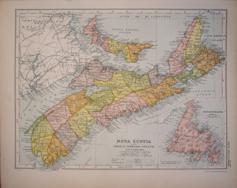 Canada: Nova Scotia & Prince Edward Island G W Bacon 1907 - 31 x 23 cm Coloured map of Nova Scotia & Prince Edward Island with an inset of Newfoundland which says it shows the Southern boundary of the French fisheries, but this is invisible! It does show the landfall of the Trinity B submarine telegraph cable. Larger image Ref nam69 : £6 Return to America Index |
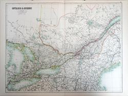 Canada: Ontario & Quebec. Adam and Charles Black's General Atlas of the World. 1895 - 58 x 42.5 cm Very large double page coloured map, with centrefold, elegantly coloured in outline. Particularly detailed rail network. Larger image Ref nam136 : £15 Return to America Index |
 Canada: Plans of Ottawa, Quebec, Toronto and Montreal. Verso: Ontario Bartholomew c 1895 - 24 x 17 cm Coloured City street plans of Montreal, Ottawa, Quebec and Toronto. Verso: Ontario divided into Districts with an inset of the Queen Victoria falls. Two images available. Larger image 1 : Larger Image 2 Ref nam47 : £15 Return to America Index |
 Canada: Province of Canada, Eastern Sheet W & A K Johnston 1861 - 57 x 44 cm A large & fine map which covers New Brunswick, Nova Scotia, Prince Edward and Cape Breton Islands and Nova Scotia. Each of the Provinces is divided into Counties. Superb hand-colouring in outline as issued makes this a beautiful map which is in very good condition. Larger image Ref nam42 : £35 Return to America Index |
 Canada: Province of Canada, Western Sheet W & A K Johnston 1861 - 57 x 44 cm A large & fine map which covers from Lake Erie and the Eastern edge of Lake Superior to the islands in the St Lawrence East of Quebec City and shows the Supposed Northern Boundary with the Hudson Bay Company's Territory. It is divided into the Counties. Superb hand-colouring in outline as issued makes this a beautiful map which is in very good condition. Larger image Ref nam41 : £35 Return to America Index |
 Canada: Province of Ontario. William Collins c1875 - 30 x 13 cm Coloured map of the province of Ontario with inset of the area around Winnipeg. The map only goes as far as North side of Lake Huron and much of the upper half of the map looking extremely scantily inhabited. The rest of Northern Ontario is not covered. Larger image Ref nam81 : £9 Return to America Index |
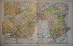 Canada: Province of Quebec with New Brunswick G W Bacon 1907 - 51 x 31 cm Coloured map of Quebec from Ottawa to the coast of Gaspe and Westmorland but only as far North as Pt de Monts on the St Lawrence. It includes an inset of the street grid of Quebec. A fine detailed map of the Districts. Larger image Ref nam68 : £13 Return to America Index |
 Canada: Province of Quebec. William Collins c1875 - 30 x 13 cm Coloured map of the province of Quebec with inset of the Gaspe Peninsula. The map only goes as far as Lake St John and much of the upper half of the map looking extremely scantily inhabited. The rest of Northern Quebec is not covered. Larger image Ref nam82 : £9 Return to America Index |
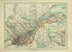 Canada: Quebec. Verso: Manitoba. W & A K Johnston 1897 - 26 x 20 cm With insets of its continuation Westwards and Anticosti Is. Verso: The area of Manitoba is the Southern half of the modern province. Nice detailed maps. Outline Colouring. Two images available. Larger image 1 : Larger Image 2 Ref nam29 : £10 Return to America Index |
 Canada: The Provinces of Ontario, Quebec, New Brunswick and Nova Scotia and Prince Edward Is. in the Dominion of Canada. Ed. Stanford 1882 - 53 x 33 cm A large two page map which can be made into a single very fine image. It is detailed and clear. Solid colouring, with some by hand. Two images available. Larger image 1 : Larger Image 2 Ref nam33 : £35 the pair Return to America Index |
 Canada: Upper Canada Geo. Philip c1907 - 48 x 35 cm Very large coloured map of Ontario divided into counties with large inset of the Great Lakes and a smaller inset of the environs of Montreal. Larger image Ref nam61 : £12 Return to America Index |
 Canada: West Sheet. J Bartholomew 1859 - 41 x 54.5 cm Large coloured double-page map of the area North of the Great Lakes. Inset of the environs of Montreal. There is some light spotting to be seen across the lakes and the US part of the map. Larger image Ref nam96 : £14 Return to America Index |
 Dominion of Canada & Newfoundland G W Bacon 1907 - 47 x 31 cm Coloured map of the whole of Canada from the Great Lakes to the North of Grant Land. Inset of the environs of Vancouver. Short closed marginal tear. Larger image Ref nam66 : £12 Return to America Index |
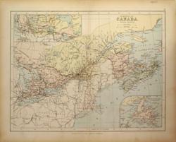 Dominion of Canada, (Eastern Provinces). George Philip c 1875 - 30 x 23 cm From Lake Superior to Cape Breton Island with Newfoundland in an inset on a reduced scale and a sketch map showing the continuation of the Dominion to the West. Light printed colour. Marginal repair at base. Larger image Ref nam31 : £9 Return to America Index |
 Dominion of Canada, Central Provinces. Adam and Charles Black's General Atlas of the World. 1895 - 39.5 x 27 cm Large coloured map, elegantly coloured in outline. Larger image Ref nam132 : £11 Return to America Index |
 Dominion of Canada, East Central Sheet A K & G H Johnston 1904 - 42 x 32 cm That portion of Canada bordering the Great Lakes and the St Lawrence River and which comprises Ontario and Quebec, showing the administrative Districts. Large map coloured in outline of an area from the Great Lakes north-westward to the St Lawrence seaway. Larger image Ref nam91 : £12 Return to America Index |
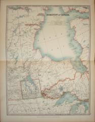 Dominion of Canada, West Central Sheet A K & G H Johnston 1904 - 32 x 43 cm Large map coloured in outline of central Canada starting near Regina and to the East includes the whole of Hudson Bay. Larger image Ref nam90 : £10 Return to America Index |
 Dominion of Canada, Western Provinces G W Bacon 1907 - 47 x 32 cm Coloured map from the Yukon and British Columbia as far West as Port Arthur. It notes the territories of the Hamkutchen, Strong Bow, Dog Rib, Beaver, Yellow Knife, Chippewayan & Cree Indians. It also shows many depots of the Hudson Bay Company. Larger image Ref nam70 : £12 Return to America Index |
 Dominion of Canada, Western Sheet A K & G H Johnston 1904 - 32 x 43 cm Large map coloured in outline of the Western part of Canada from the Yukon and British Columbia as far West as Port Arthur. It shows mountain ranges and rivers with great clarity and the rail-roads but this emphasise the lack of population and the wildness of much of this land. A handsome map. Larger image Ref nam89 : £12 Return to America Index |
 Dominion of Canada. Adam and Charles Black's General Atlas of the World. 1895 - 39 x 27 cm Large coloured map, elegantly coloured in outline. Larger image Ref nam134 : £11 Return to America Index |
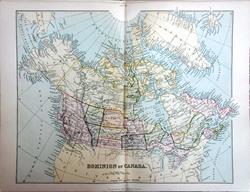 Dominion of Canada. With Greenland and Iceland. Wm. MacKenzie c1885 - 28.5 x 22 cm Detailed original antique coloured map showing the Provinces and the Northern Territories far above the Arctic Circle with the latest expedition in 1876-8. Centrefold as issued. Sold with 6 pages of associated text. Larger image Ref nam139 : £11 Return to America Index |
 North America. A K & G H Johnston 1904 - 34 x 43 cm Large map coloured in outline of the whole of the subcontinent. Clearly defining the railroads and delineating possible North-West Passages. A very handsome map indeed. Larger image Ref nam93 : £12 Return to America Index |
 North America. Geo. Philip c1907 - 48 x 35 cm Very large coloured political map of North America with an inset showing population density. Larger image Ref nam65 : £10 Return to America Index |
 North America. William Collins c1875 - 23 x 30 cm Coloured map of the whole subcontinent. Boundaries of the States are now delineated but Canada is still largely undefined internally. Larger image Ref nam76 : £10 Return to America Index |
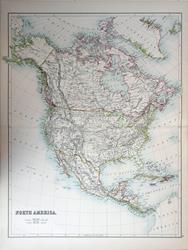 North America. Adam and Charles Black's General Atlas of the World. 1895 - 42 x 54 cm Very large double page coloured map, with centrefold, elegantly coloured in outline. Larger image Ref nam135 : £15 Return to America Index |
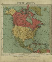 North America. Bartholomew 1866 - 21 x 22 cm From Grinell Land to Panama to Trinidad. Solid colour, somewhat grubby overall. Larger image Ref nam35 : £7 Return to America Index |
 North America. Ed. Stanford 1882 - 28 x 33 cm From the North of Greenland to Panama and just showing San Domingo. Each Country delineated in a separate solid colour, with some by hand. A very good looking map Larger image Ref nam23 : £22 Return to America Index |
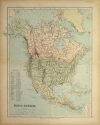 North America. George Philip c 1875 - 24 x 30 cm From the North of Greenland to Panama. Table of reference to the States. Principal Rail-roads. Solid printed colour. Small smudge in the Atlantic. Larger image Ref nam21 : £10 Return to America Index |
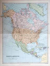 North America. J Bartholomew/Wm. MacKenzie c1885 - 22.5 x 28 cm Original antique coloured map. Centrefold as issued. Sold with 3 pages of associated text. Larger image Ref nam138 : £9 Return to America Index |
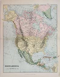 North America. Wm MacKenzie c1880 - 22 x 27.5 cm Clear coloured map of the Continent from Costa Rica to the Arctic Circle, showing rivers, mountains and Lakes. Centrefold as issued. Larger image Ref nam102 : £9 Return to America Index |
 North America. Industrial North America with Communications Geo. Philip c1907 - 48 x 35 cm Very large coloured map of North America as far South as the Caribbean, showing Trade Routes and a mass of Steamer Routes. Sources of crops and products, especially animal and mineral products, shown including Nat-gas, Henequen, Marble, Nickel and Quicksilver. Stain in lower corners of margin (see image). Larger image Ref nam64a : £12 Return to America Index |
 North America. Verso: N America, Physical W & A K Johnston 1897 - 20 x 26 cm From the North of Greenland to Trinidad and Panama. Outline coloured. Larger image Ref nam03 : £9 Return to America Index |
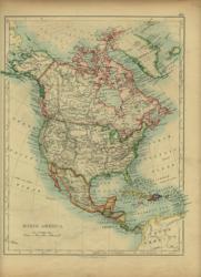 North America. Verso: N America, Physical W & A K Johnston 1896 - 20 x 26 cm From the North of Greenland to Trinidad and Panama. Outline coloured. Larger image Ref nam04 : £9 Return to America Index |
> Section 1 > Section 2 | |||