| Home Page | Buying | Maps | Books | Prints | Ephemera |
- Home Page
- North America
- Central America and West Indies
- South America

1,500 maps reduced in price
All our maps are Originals, NOT modern reproductions
Now all our maps have thumbnails as well as larger images so finding what you want is quicker.
If you want several items, email me for a discount!
Email: don@theoldmapman.com
 Cuba, Lesser Antilles & British Honduras. Verso: Jamaica, Bahamas, Trinidad & Bermuda. W & A K Johnston 1896 - 20 x 26 cm Three maps of Cuba, British Honduras and one covering from Haiti (The East, now the Dominican Republic) Puerto Rico, the Virgin Islands and the Windward Islands. Verso: Four maps of these islands with the largest being a detailed map of the Bahamas Islands (sic). Two images available. Larger image 1 : Larger Image 2 Ref cam05 : £9 Return to America Index |
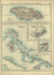
 Jamaica, Bahamas, Trinidad & Bermuda. Verso: Cuba, Lesser Antilles & British Honduras W & A K Johnston 1897 - 20 x 26 cm Four maps of these islands with the largest being a detailed map of the Bahamas Islands (sic). Verso: Three maps of Cuba, British Honduras and one covering from Haiti (The East, now the Dominican Republic) Puerto Rico, the Virgin Islands and the Windward Islands. Two images available. Larger image 1 : Larger Image 2 Ref cam04 : £9 Return to America Index |
 Panama Canal: Plan & Section Wm. MacKenzie c1885 - 22 x 12 cm Original antique coloured map. With a related page of text. Larger image Ref cam25 : £9 Return to America Index |
 West India Islands A K & G H Johnston 1904 - 44 x 32 cm Large map coloured in outline of the West India Islands and Central America from Little Bahama Bank to Trinidad and showing the administration of the Leeward and Windward Islands. Short strengthening of the bottom of the centrefold. Larger image Ref cam19 : £9 Return to America Index |
 West India Islands Bartholomew/ A&C Black 1873 - 39 x 28 cm This coloured map shows all the Islands in some detail from the Bahamas to Trinidad. A large map. An inset map of Jamaica on a larger scale. Very good condition. Larger image Ref cam12 : £12 Return to America Index |
 West India Islands W & R Chambers 1868 - 27 x 22 cm Map of the islands from the Bahamas to Trinidad. Fine early colour printing. Larger image Ref cam23 : £13 Return to America Index |
 West India Islands. Verso: Mexico W & A K Johnston 1897 - 27 x 20 cm The West Indies from Salvador and British Honduras in the West to Barbados and Trinidad in the East. Verso: Mexico and the Southern United States to Costa Rica. Coloured in outline. Two images available. Larger image 1 : Larger Image 2 Ref cam03 : £9 Return to America Index |
 West Indies, Greater Antilles Geo. Philip c1907 - 35 x 23 cm Large coloured map of the Bahamas, Cuba, Jamaica, Great Cayman, Haiti and Domingo. Larger image Ref cam15 : £9 Return to America Index |
 West Indies, Lesser Antilles Geo. Philip c1907 - 23 x 35 cm Large coloured map of Jamaica, British Guiana and the chain of Leeward and Windward Islands. Larger image Ref cam16 : £9 Return to America Index |
|||
| |||